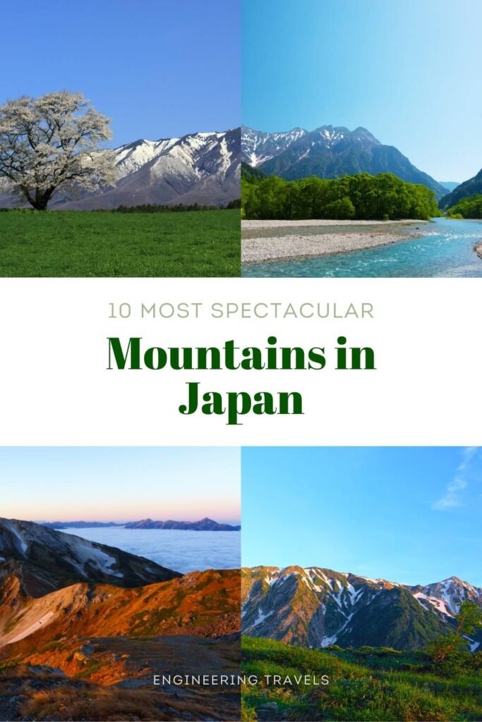
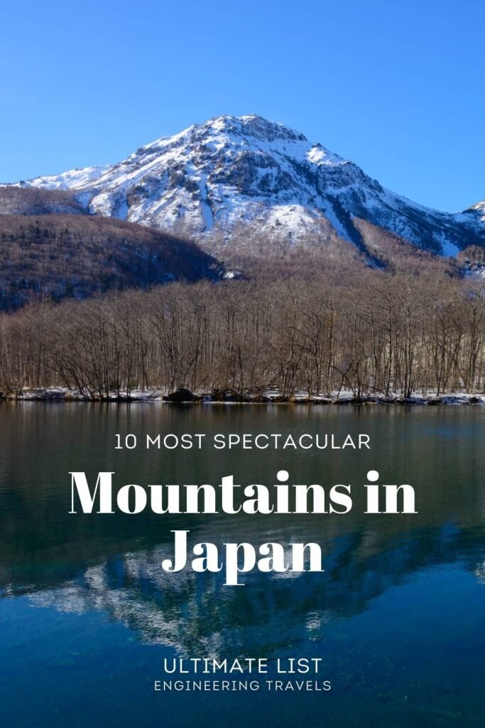
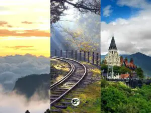
10 Beautiful Mountains In Japan (with Hiking Information)
I love mountains because they fill me with awe and happiness. When I climb and reach the summit, I feel like I’m on top of the world. It empowers me to overcome my fears. If I can conquer a mountain, I can conquer anything.
Before I visited Japan, I had no idea what its mountains looked like, except for Mount Fuji. As I planned our itinerary for next visit, I discovered many other mountains in Japan. I was amazed by how spectacular they were, comparable to the European Alps or the Canadian Rockies!
Today, let me share with you the most beautiful mountains in Japan that I found. I also include the nearest city or town to each mountain, so you can easily visit them. Additionally, I provide some facts and hiking information to give you more insight into these natural wonders.
This post contains affiliate links. I may receive a tiny commission at no additional cost to you.
Use the table of contents to skip to topics.
Check out my other articles about Japan.
There is a book that you should know about before we proceed: 100 Famous Japanese Mountains. It was written by the mountaineer Kyuya Fukuda in 1964. It contains a list of the most beautiful mountains in Japan, which he selected based on grace, individuality, and history.
The book gained popularity when Emperor Naruhito, who was then a prince, mentioned it. Since then, it has motivated many people to climb all the summits of these 100 peaks.
I used this book, or at least the 100 mountains in it, as a reference for choosing the mountain ranges to feature in this post. All the peaks that I will mention are also among Kyuya Fukuda’s best choices.
However, I did not rely solely on his book. I also did my own research, watched YouTube videos, and scanned hundreds of photos on the internet to pick my 10 Best Mountains in Japan.
Are you planning a trip to Japan? Here are the links where you can find the best hotel deals and the best experiences in Japan.

1. Mount Yari
Rising from the Northern Japan Alps, Mount Yari is a majestic mountain that spans the Nagano and Gifu prefectures. Its peak, which resembles a spearhead, gives it its name: Yari, or “spear” in Japanese.
It is a sight to behold, as it reaches 3180 meters or 10,433 feet above sea level, making it one of the tallest mountains in Japan. It is also known as the “Matterhorn of Japan”, because of its similarity to the iconic mountain in Switzerland
Mount Yari Interesting Facts
Did you know that the first-ever man to reach the summit of Mount Yari was a Buddhist priest named Banryu? He climbed the peak in 1828 and recorded his achievement. Fifty years later, another climber followed his footsteps. His name was William Gowland, and he was the first foreigner to conquer Mount Yari.
Nearest Town to Mount Yari
It may be hard to determine where the peak of Mount Yari is from afar. However, we can go to Matsumoto in Nagano prefecture to have a spectacular view of the Northern Japan Alps, where Mount Yari lies. Matsumoto is also the starting point for hiking Mount Yari.
How hard is it to hike Mount Yari?
Climbing Mount Yari requires following the Kamikochi Course, a 38.5-kilometer (24 miles) out and back trail that starts from Matsumoto. This course involves a whopping 2321 meter (7614 feet) elevation gain, which can be very difficult for beginners.
The last 6 kilometers of the trail are the steepest, with an elevation gain of 1500 meters or 4921 feet. However, the first 10 kilometers of the course are mostly flat and slightly easier to hike.
Source: alltrails.com
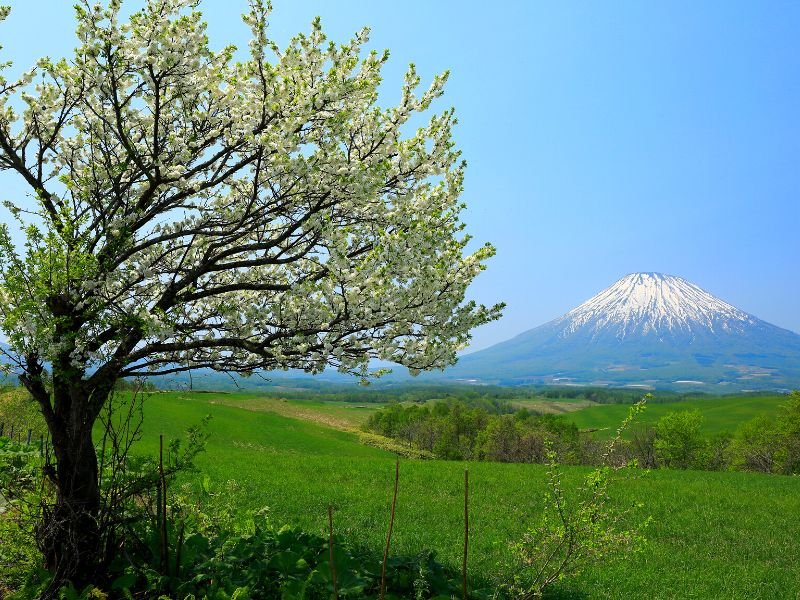
2. Mount Iwate
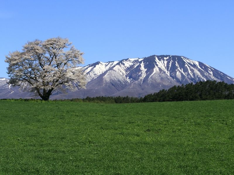
Mount Iwate is a majestic mountain in the northern part of Honshu Island in Japan. It stands at 2,038 meters or 6,686 feet, making it the highest peak in Iwate prefecture.
It is also one of Japan’s ultra-prominent peaks, with a topographic prominence of 1,745 meters or 5725 feet. This means that it has a distinct shape that can be seen from far away. This is why I added it to my list of beautiful mountains of Japan..
Additionally, Mount Iwate has a graceful curve that touches the sky, giving it a charm similar to Mount Fuji. In fact, it is also known as Nanbu Fuji because of its resemblance to the iconic mountain.
Mount Iwate Interesting Facts
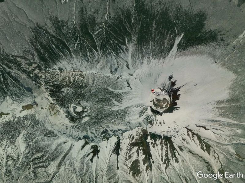
Thousands of years ago, Mount Iwate was a “twin” symmetrical stratovolcano with two parts. They were called Higashi-Iwate, meaning “East Iwate,” and Nishi-Iwate, or “West Iwate.”
After an eruption, the east volcano collapsed, forming a caldera. Today, this caldera looks like a valley in the middle of Mount Iwate. It creates a fascinating scene from the sky as it appears to be a unique earth formation that we can only find in Japan.
Nearest Town to Mount Iwate
You can enjoy the best view of Mount Iwate from the Solitary Cherry Tree at Koiwai Farm. This is the place in the photo where a cherry tree stands on a lush green field, with Mount Iwate in the background.
However, if we want to see Mount Iwate’s resemblance to Mount Fuji, we should go to Takizawa Area. This is also the town where we can start hiking and climbing Mount Iwate.
How hard is it to hike Mount Iwate?
Climbing Mount Iwate is a challenging but rewarding adventure. One of the most popular routes is the Yanagisawa Course, which starts and ends near Takizawa. This course is rated as “difficult” because it covers 11.4 kilometers (7 miles) and has a “huge” elevation gain of 1419 meters or 4327 feet.
However, the trail also offers excellent opportunities to watch birds and see beautiful wildflowers. The panoramic views from the top of the mountain are worth the effort.
Source: alltrails.com
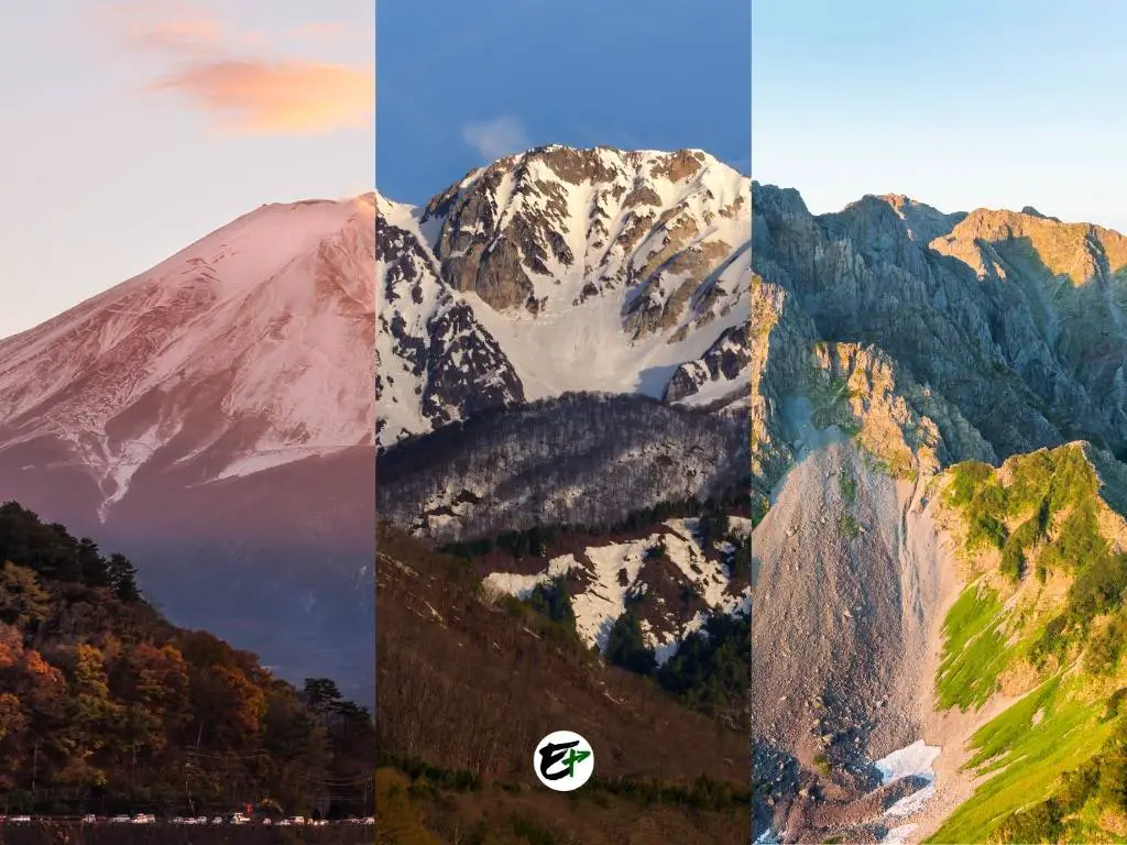
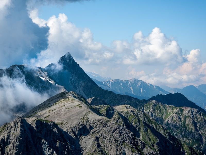
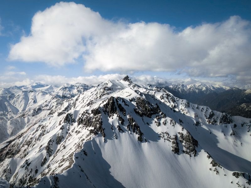
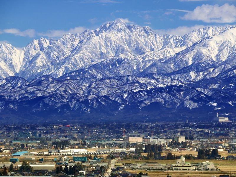
3. Mount Tsurugi
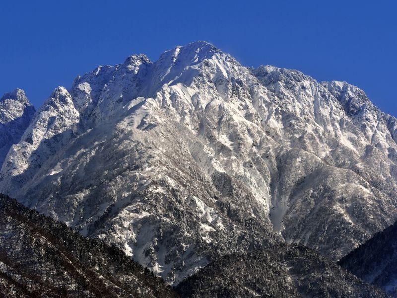
Mount Tsurugi is known as the most dangerous mountain that can be climbed and the premiere mountaineering peak in winter. This Japanese mountain stands at 2,999 m (9,839 ft) and has world-class long routes that test the skills of the most experienced hikers worldwide.
Despite its danger, Mount Tsurugi has fewer fatalities than the much smaller Mount Taniwaga in Gunma prefecture. Mount Tsurugi is located among other towering peaks in the Northern Japan Alps in Nagano, Toyama, and Gifu Prefectures.
Its beauty and appeal lie in its visually distinctive peak that outshines other mountains. The peak of Mount Tsurugi looks like a rugged jewel in a crown, resting in the middle of the mountain ranges. This scene is especially stunning in winter, when the snow turns it white.
Mount Tsurugi Interesting Facts
Mount Tsurugi was the last of Japan’s “major” peaks to be summited. The “first-ever” successful climb of this mountain happened in 1906.
However, the first climbers of Mount Tsurugi were surprised when they reached the summit. They found a 12th-century sword and staff at the peak, which suggested that someone had been there before them. This created a mystery that still remains unresolved.
Nearest Town to Mount Tsurugi
You can visit several towns and cities near Northern Japan Alps and Mount Tsurugi to enjoy the scenery.
In Toyama Prefecture, the nearest towns to the mountains are Tateyama and Kamiichi. The trek to the summit of Mount Tsurugi starts from here. However, the towns on the other side of the Northern Japan Alps are much closer to the peaks.
In Nagano Prefecture, you can visit Hakuba. This town provides a better view of the mountains and many skiing resorts. You can easily travel between the two sides of the Northern Japan Alps by using the Tateyama Kurobe Alpine Route.
This is a route that offers a scenic passage across the mountains from Toyama to Nagano Prefecture and vice versa. Visiting both sides of the mountain range would be more enjoyable than exhausting with this route.
How hard is it to hike Mount Tsurugi?
Mount Tsurugi is a challenging hike that begins from Kezanso in Nakaniikawa district, Toyama. The trail is an out & back route that is about 4.5 kilometers long.
The course is rated “hard” because it has an elevation gain of 571 meters. You need to have enough climbing experience to attempt this hike.
Source: alltrails.com
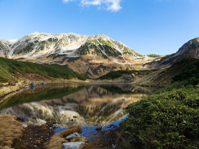
4. Mount Goryu
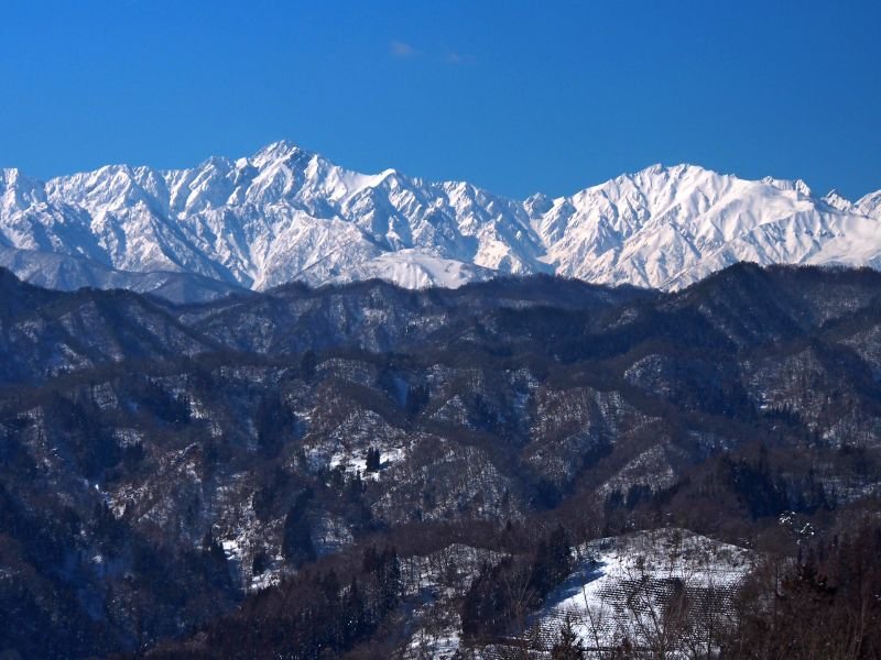
Mount Goryu is a part of the Northern Japan Alps in Chubusangaku National Park. It has a summit elevation of 2814 meters. The mountain has a rugged and jagged appearance that creates a stunning alpine landscape.
The hike to Mount Goryu is challenging but rewarding. It takes you through a spectacular V-shaped ridge that connects to another peak, Mount Kashimayari. Along the way, you can enjoy the views of wildflowers, rocky peaks, and alpine lakes.
Nearest Town to Mount Goryu
Mount Goryu is a beautiful mountain in Nagano Prefecture, best observed from two towns.
One is Habuka, where you can get a closer view of the mountain from the ski resorts. The other is Ogawa Village, where you can get a more scenic but farther view of the mountain. The images above show how the mountain looks like in winter.
How hard is it to hike Mount Goryu?
The hike to Mount Goryu’s summit begins in Jizonokashira, west of Kamishiro station in Kitaazumi District, Nagano prefecture. The trail is 14.3 kilometers long and has an elevation gain of 1428 meters.
The climb is rated “hard” and requires ladders and chains, especially on the rocky ridgeline. The trail also has a steep 300-meter variation in elevation along some sections. You should wear a helmet for safety.
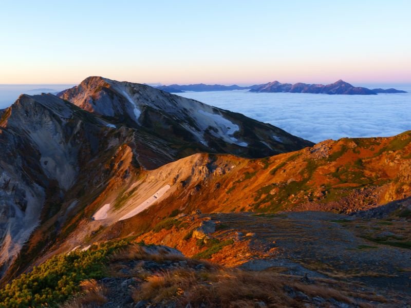
5. Mount Hotaka
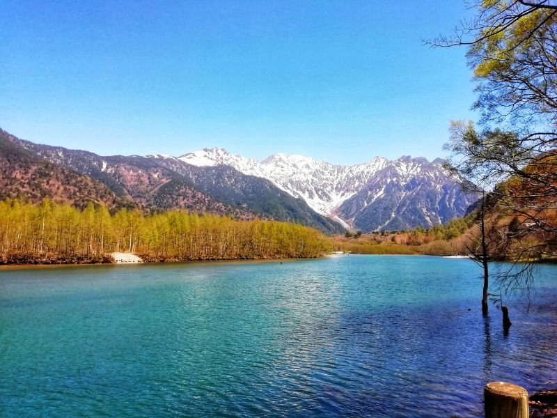
Mount Hotaka is the tallest mountain in the Northern Japan Alps, with a height of 3,190 m (10466 ft). It is also known as the “Leader of the Northern Alps” and one of the Japanese Ultra Peaks, with a prominence of 2,307 m (7569 ft).
The mountain has a pyramidal peak at the summit that offers a spectacular view to the climbers. The hikers can also admire the mountain from a distance, with the rivers flowing from it. The rocky body of Mount Hotaka resembles the Canadian Rockies on the other side of the globe.
Mount Hotaka is located in Gifu and Nagano Prefectures, along with other rocky mountains such as Mount Tanigawa and Mount Tsurugi.
Mount Hotaka Interesting Facts
Mount Hotaka is where we can see cirques, amphitheater-like valleys formed by glacial erosion similar to those in the European Alps. The cirque in Mount Hotaka is called Karasawa Cirque, one of the major attractions of the mountains.
Nearest Town to Mount Hotaka
Checking the summit of Mount Hotaka from the lower grounds may be difficult or even impossible, but we can always go to Matsumoto in Nagano prefecture to get a spectacular view of the Northern Japan Alps, where Mount Hotaka is located.
The city of Matsumoto can also be our preferred gateway to Kamikochi, where we can start our climb to the summit of Mount Hotaka.
How hard is it to hike Mount Hotaka?
Different climbing trails can lead us to the summit of Mount Hotaka. Each trailhas different levels of climbing skills required. The routes can be just basic ones, like the Kamikochi to Karasawa Trail.
However, hikers looking for a challenge can take the adventurous and strenuous Kamikochi-Yari-Hotaka Circuit. It is a loop trail that starts and ends in Kamikochi and has an elevation gain of 1685 meters or 5528 feet.
Some trails feature climbing a steel ladder and scrambling on steep rocky ridges. All these are for the heavenly beauty reward that can be claimed at the summit.
Sources: thejapanalps.com, japan-guide.com
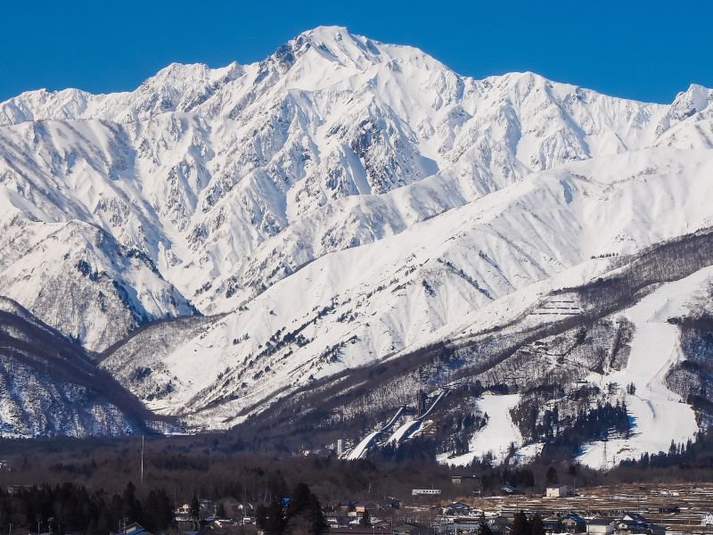
6. Mount Shirouma
Mount Shirouma, or the “White Horse Mountain,” is the 26th tallest mountain in Japan. It stands in the Northern Japan Alps, reaching an elevation of 2,932 meters (9,619 ft) above sea level.
The beauty of Mount Shirouma can be clearly observed at its peak, where we can see polished edges of Earth that look like the curves of a Kris sword.
Mount Shirouma is one of the peaks targeted by Japanese mountain climbers who seek to try the spectacular asymmetrical ridges that extend north to south of the mountain.
Mount Shirouma Interesting Facts
Mount Shirouma is one of the few remaining peaks in Japan where we can see year-round snowfields called firn. Firn is the leftover snow from the past winter season that has been crystallized into a denser substance. Firn looks like wet sugar, but it is hard and resistant to shoveling. It is the stage in the middle of the snow being snow and glacial ice.
Aside from that, it is here that we can find the Hakuba Daisekkei Gorge, Japan’s “largest” snowy gorge.
Nearest Town to Mount Shirouma
The village of Hakuba in the Kitaazumi district is the nearest place to observe the scenic alpine views of Mount Shirouma in awe. It is also the place where we can ski and start hiking the mountain.
How hard is it to hike Mount Shirouma?
Climbing Mount Shirouma follows an out and back route of 6.8 kilometers or 4.2 miles in length with an elevation gain of 1034 meters or 3392 feet. It is considered “hard,” but other routes are available that first-time hikers could try.
However, some websites say the trail to Mount Shirouma starts in Surakawaso or Hakubajiri. If we compute, it’s an additional 4 (approximate) kilometers or 2.49 miles to be added to the 6.8 kilometers stated on alltrails.com.
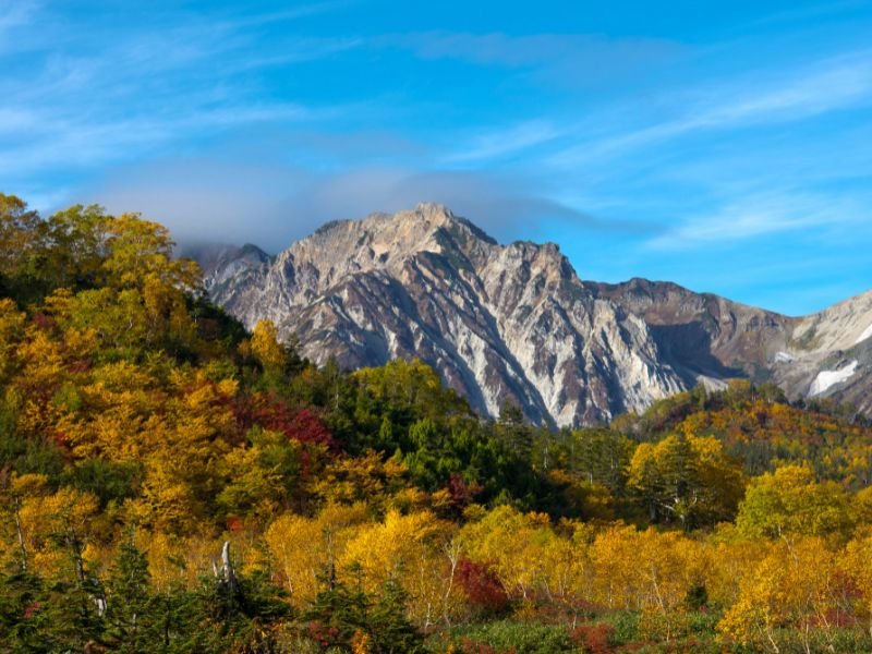
7. Mount Yake
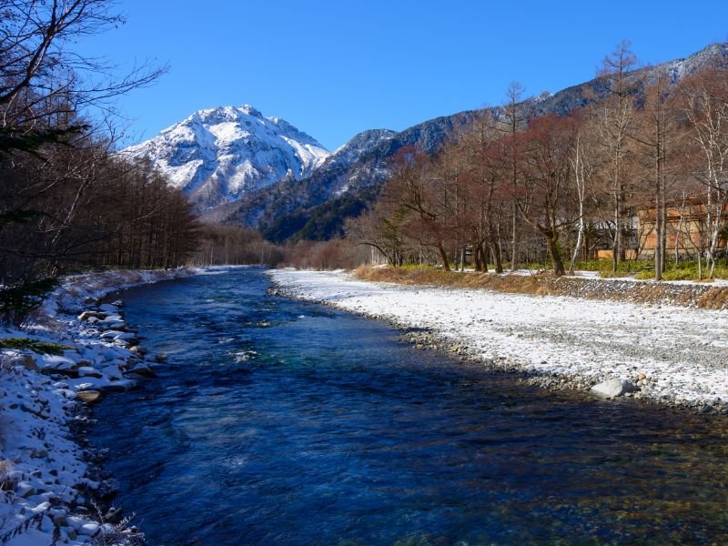
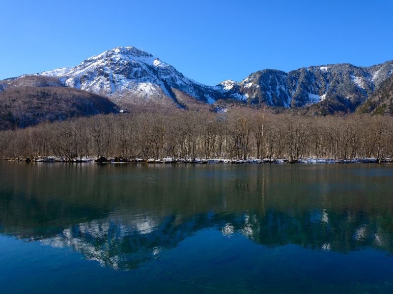
Mount Yake, the “Burning Mountain,” is a 2,455 m (8,054 ft) tall mountain between Matsumoto, Nagano Prefecture, and Takayama, Gifu Prefecture. It is a mountain in the Northern Japan Alps with two peaks and a crater lake in between. It is also an active volcano that produces onsen in nearby areas.
Mount Yake might not be as majestic as the other mountains in the Northern Japan Alps, but it has volcanic power that gives it a stunning sight that now attracts thousands of tourists yearly.
In 1915, Mount Yake erupted, unleashing a massive amount of lava into the Asuza River. It dammed the river, creating Lake Taisho. Now Lake Taisho reflects the image of its creator, giving wonder to anyone who comes to see it.
Another reason why Mount Yake is beautiful is because of the three colors of nature we can see on the mountain, especially during the autumn season. The foot of the mountain is green, turning yellow and red as we climb higher.
Mount Yake Interesting Facts
At the summit of Mount Yake, we can find an opening of the planet’s crust, also called a fumarole. It is a wonder to behold, but we must be cautious as it blows volcanic gases that are dangerous to our health. Mount Yake is the last active volcano in the Northern Japan Alps.
Nearest Town to Mount Yake
Matsumoto in Nagano Prefecture is the nearest town to Mount Yake. It is where we can sightsee the mountain or start climbing it. The best viewing spot, however, is at the Taisho Pond. We can reach the pond just before Kamikochi if we are from the town of Matsumoto.
How hard is it to hike Mount Yake?
Climbing Mount Yake is rated “hard,” with an 8.9-kilometer or 5.5-mile climbing trail with an elevation gain of 1119 meters or 3671.3 feet.
The hiking trail going up to the summit of Mount Yake is called the Shin Nakanoyu Route, and it starts in Nakanoyu, near the town of Matsumoto in Nagano prefecture. It is a suitable trail for new climbers, but it is recommended to plan and prepare accordingly.
Source: alltrails.com
8. Mount Tate
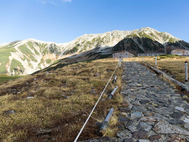
Mount Tate, or simply Tateyama, is one of the tallest mountains in Japan and in the Northern Japanese Alps, reaching 3,015 m (9,892 ft) above sea level. It is considered one of Japan’s “Three Holy Mountains,” along with Mount Fuji and Mount Haku.
Mount Tate is located in the southeastern area of Toyama Prefecture, the starting point of the Tateyama Kurobe Alpine Route. The creation of the Alpine Route made Tateyama one of the most developed mountain tourist destinations in Japan, next to Mount Fuji.
We can find cable cars, tunnels, hotels, dams, funiculars, tramways, and onsen baths here. There’s even a shrine at the summit!
Mount Tate Interesting Facts
Tateyama is one of the places in Japan with the highest snowfall. There, the snow accumulates up to 20 meters every year. At the start of spring, the snow is removed from the roads, creating a spectacular snow wall that everyone can explore on foot.
The snow wall starts from the highest-altitude bus station in Japan, the Murodo Bus Terminal. It is also the start of the 500-meter-long trip to the fantastic icy white world, perfect for spending time during winter and spring.
Tateyama is also the only place in Japan where glaciers exist, according to japantimes.co.jp.
Nearest Town to Mount Tate
At the base of Mount Tate is Tateyama, the town gateway to the great adventures and jaw-dropping scenery along the Tateyama Kurobe Alpine Route.
However, public transportation from Tateyama Town can take us directly to the Murodo Plateau in a snap. It is where we can start hiking and sightseeing the many stunning views of the Northern Japanese Alps in Tateyama.
How hard is it to hike Mount Tate?
The complete experience of hiking Mount Tate follows the Three Peak Circuit Hike from the Tateyama Murodo. This course is moderately easy, but it could take up to three days to finish. The hiking trail has a 755 m (2477 ft) elevation gain and a total horizontal distance of 13.3 kilometers (8.26 miles).
Source: hikesinjapan.yamakei-online.com
9. Mount Yotei
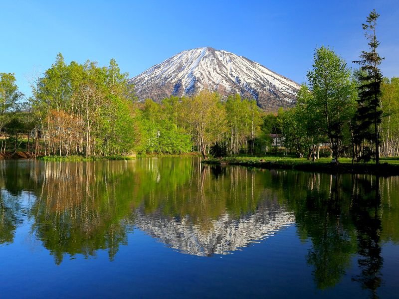
“Yezo Fuji,” “Makkari Napuri,” “Mount Shiribeshi.” These are some of the names given to Mount Yotei, the “Mount Fuji” of Hokkaido. It is a mountain and a volcano that’s 1,898 m (6,227 ft) in height and 1,878 m (6,161 ft) in prominence.
It is not included among Japan’s tallest mountains, but it is regarded as one of Japan’s Ultra peaks. Mount Yotei is a stratovolcano that we can visit inside the Shikotsu-Toya National Park.
The name “Yezo Fuji” came from the combination of “Ezo,” the old name of the island of Hokkaido, and “Fuji” because it resembles Mount Fuji. Its name alone is a solid and justified reason why it belongs to this list of the most beautiful mountains in Japan.
Mount Yotei Interesting Facts
Unlike most of the mountains in the world, where people can ski on the slopes of the mountainside, Mount Yotei allows skiers to ski in its crater. It might sound weird, but people do it! The snow in the crater of Mount Yotei is thick and powdery. That’s why even if it requires them to hike for hours, they still go there and play with the snow
Nearest Town to Mount Yotei
There are five towns around Mount Yotei where we can spot the mountain: Niseko, Makkari, Kimobetsu, Kyogoku, and Kutchan. What’s “cool” about these towns is that their borders meet at the center of the crater. So technically, by hiking around the “mouth” of the mountain, we can visit all these five towns in just a day, on foot.
However, the mountain has a nature park that can be accessed from the town of Makkari. It is also the place where we can start the hike to the summit of Mount Yotei.
How hard is it to hike Mount Yotei?
Hiking Mount Yotei is rated “hard.” The course is a loop that circles the crater, with a total length of 16.4 kilometers (10.2 miles) and an elevation gain of 1565 meters (5134.5 feet).
It starts and ends at the Yotei Nature Park in the town of Makkari. Hiking can be finished in a day, but we can also stay overnight at the top.
A hut at the summit can accommodate us for the night, allowing us to watch the sunset and sunrise if the weather permits.
source: alltrails.com
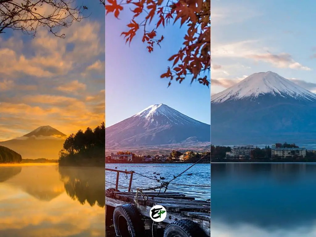
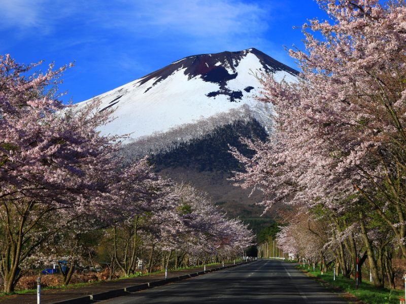
10. Mount Fuji
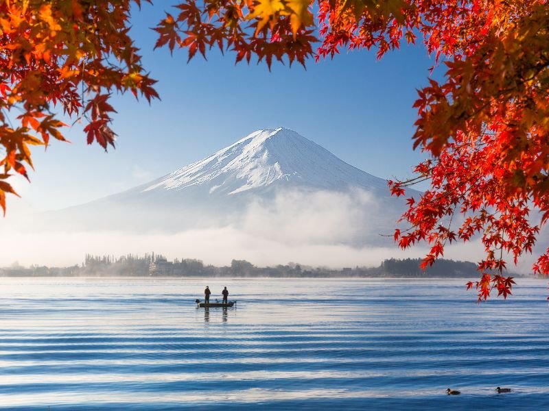
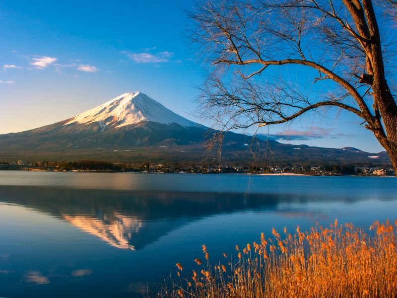
Last and, of course, not least, but the best of all, is Mount Fuji. It is the highest mountain in Japan, reaching 3776 meters (12388 ft). This mountain holds more value than any other mountain in Japan in terms of grace, individuality, and history.
Mount Fuji is an active stratovolcano with a spectacular symmetric cone-shaped body. With that, any place or thing with Mount Fuji in the background becomes instantly photogenic.
It is the icon of Japan known in every corner of the world.
Mount Fuji Interesting Facts
- It is the number 1 most climbed mountain in the world. There are around 300,000 climbers who hike and climb mount Fuji every year.
- Its last eruption lasted for 2 weeks in 1707. Thankfully it never erupted again.
- Mount Fuji is made up of 3 volcanoes. Komitake at the bottom, Kofuji in the middle, and Fuji at the top.
- Mount Fuji has 4 trails to the summit. The Yoshidaguchi Trail is the “easiest” and the most beginner-friendly trail.
- 5 lakes surround Mount Fuji – these Japanese lakes are the best spot to photograph mount Fuji more than anywhere else.
Nearest Town to Mount Fuji
There are many towns and cities that surround Mount Fuji. Each has “special” spots where we can visit to view Mount Fuji. But if we are looking for the best scenery with this mountain as the backdrop, two of the places we should try are Fujikawaguchiko and Yamanakako.
How hard is it to hike Mount Fuji?
There are 4 trails available to climb mount Fuji. They have different levels of difficulty.
- Yoshida Trail – “Zigzag path on the relatively flat ground surface up to the 7th station. Slightly rocky beyond the 7th station.”
- Subashiri Trail – “Relatively gently sloped and tree-covered near the 7th station.”
- Gotemba Trail – “Gentle slope of volcanic gravel near the 8th station.”
- Fujinomiya Trail – “Generally very rocky and steep.”
Read more about these trails from the official website of Mount Fuji Climbing.
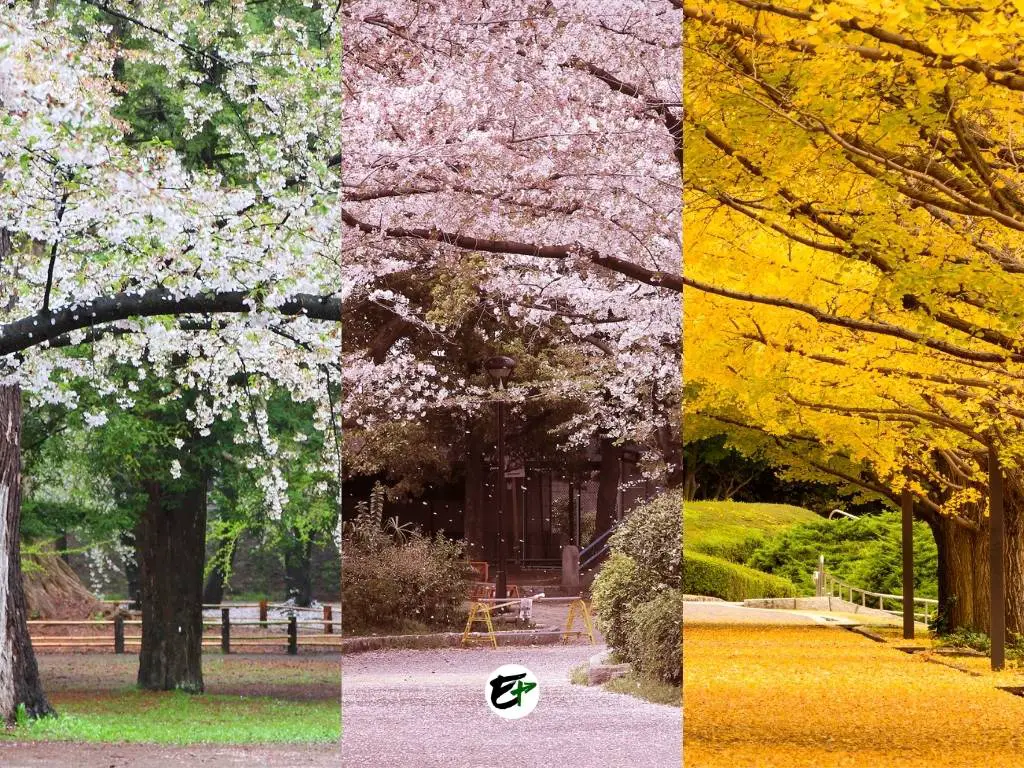
Save it on Pinterest.