10 Famous Mountain In The Philippines (Hiking Bucket List)
As a Filipino, I take great pride in our country’s stunning white sandy beaches, vibrant marine life, and breathtaking sunsets. You’ll find these natural wonders in abundance, whether you’re in Luzon, Visayas, or Mindanao!
Our mountains may not receive as much international recognition as our islands and beaches, but they are equally deserving of our pride. I can attest to their beauty, having witnessed it firsthand.
In this blog post, I’ll introduce you to 10 of the most famous mountains in the Philippines. These mountains are beloved by Filipino hikers. If you’re looking for a hiking bucket list in the Philippines, these are the mountains that you are looking for.
This post contains affiliate links. I may receive a tiny commission at no additional cost to you.
Use the table of contents to skip to topics.
How I picked the 10 famous mountains in the Philippines (a mini study)
Did you know that the Philippines has thousands of mountains? This is because of the country’s volcanic history, which goes back millions of years. These mountains vary in height, from a few hundred meters to almost 3000 meters above sea level. Peakvisor says that over 3000 of these mountains have names.
With so many mountains, it’s hard to say for sure which ones are the most beautiful or best for hiking. But we can figure out which ones are the most famous. These are the mountains that hikers and photographers love.
To make the list in this post, I did something simple. I looked at the Instagram account of SinoPinas. I looked at their photos and checked out all the mountains they showed. Then I counted up the results. The mountains that SinoPinas showed the most ended up on this list.
Why did I choose SinoPinas? I picked SinoPinas for this mini-study on the Philippines’ most famous mountains for a few reasons. First, local knowledge: Filipinos know the beauty of the Philippines better than anyone else. SinoPinas is a platform made by Filipinos, for Filipinos. Second, community focus: SinoPinas is a group of Filipinos who want to explore the Philippines. They want to learn about its beauty, culture, and people, one place at a time. I’m sure that the mountains SinoPinas shows are as beautiful in real life as they are in pictures.
From the start of 2020 until March 2021, I found 168 photos of different mountains in the Philippines on SinoPinas’ Instagram account. The mountains shown in these photos are listed below.
50 Mountains Featured by SinoPinas
- Igcoron
- Kupapey
- Arayat
- Mayon
- Balagbag
- Marami
- Nangtud
- Pulag
- Bulusan
- Espadang Bato
- Kandungaw Peak
- Amuyao
- 387
- Apo
- Gulugod Baboy
- Guiting Guiting
- Ulap
- Tarak
- Kom-Kompol
- Dulang Dulang
- Irid
- Yangbew
- Maculot
- Lammin
- Binacayan
- Upao
- Lubog
- Ugo
- Isarog
- Timbak
- Kalugong
- Pico De Loro
- Banahaw
- Pinatubo
- Minandar
- Kitanglad
- Minandiraan
- Iglit-Baco
- Balingkilat
- Tabulhik
- Iraya
- Treasure Mountain
- Cayabu
- Ugis
- Batulao
- Tenglawan
- Polis
- Wiji
- Mapalad
- Pamitinan
Among the 50, the 10 most featured by SinoPinas (the most famous mountains in the Philippines) are:
| Mountain | No. of Times Featured |
|---|---|
| Pulag | 39 |
| Mayon | 23 |
| Kupapey | 9 |
| Apo | 9 |
| Guiting Guiting | 9 |
| Balagbag | 8 |
| Ulap | 6 |
| Pinatubo | 6 |
| Dulang Dulang | 5 |
| Ugo | 3 |
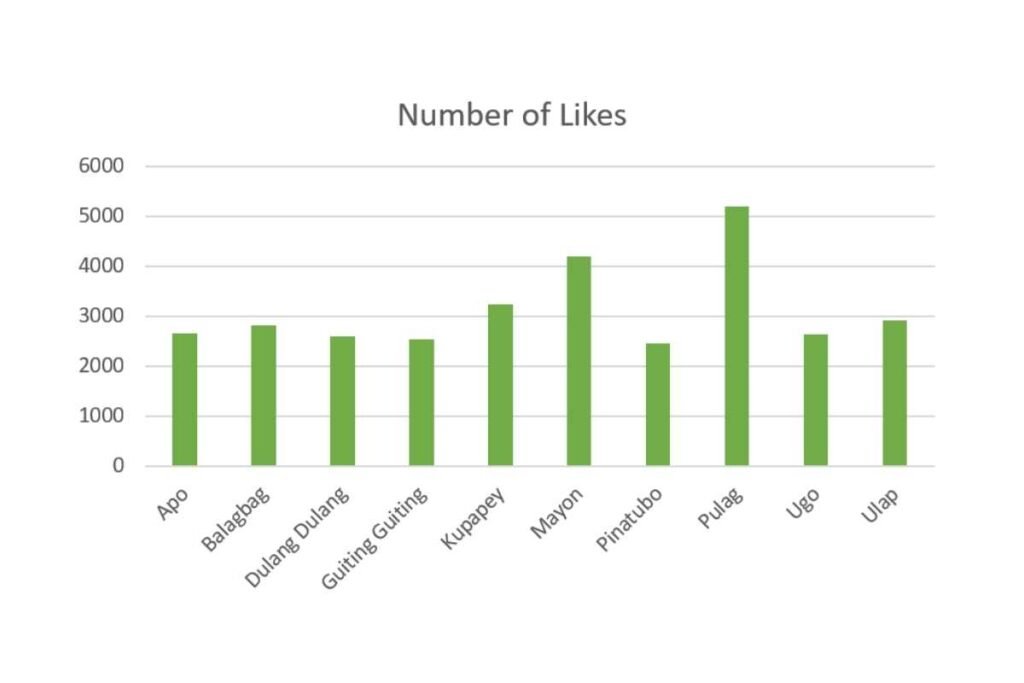
Here is a graph showing the number of likes of each mountain (based on their most liked photo):
Read my other blog posts about the Philippines
Planning a trip to the Philippines? You can start looking for the top experiences here and the best hotel deals here.
10 Famous Mountains In The Philippines
Now, let me introduce you to 10 of the most famous mountains in the Philippines. I’ll provide a brief overview of each, including their elevation, location, and notable features. This will give you an idea of how to reach the starting point of each hike and how challenging these hikes can be.
For a better understanding of how hikers in the Philippines classify mountains based on difficulty, I recommend checking out PinoyMountaineer.com (link provided in the resources section).
But in a very brief summary:
- Minor hike = for everybody. Usually, these hikes are only day hikes. But some may involve overnight camping.
- Major hike = challenging. These hikes typically last for more than 2 days.
10. Mount Ugo
Let’s kick off the list of the most famous mountains in the Philippines with Mount Ugo, a 2150-meter tall mountain in the provinces of Nueva Vizcaya and Benguet.
Mount Ugo, despite being a major hike, is a popular hiking destination in the Philippines. Hundreds of mountaineers hike up Mount Ugo for an epic view at its peak yearly.
On the hiking trails of Mount Ugo, you will be passing through pine forests and highland villages inhabited by natives. There are parts of the hiking trail where you can already see a view of the Cordillera mountain range, which can be so motivating to reach the summit. You can witness a view of a sea of clouds from Mount Ugo’s summit, making it a compelling mountain to climb.
What can serve as a twist in your hiking experience on Mount Ugo are the ghost stories echoing in the ears of the hikers visiting Mount Ugo. Mount Ugo is rumored to be haunted by the people who died in aircraft accidents that happened in 1960 and 1987.
Believe it or not, the established guide system in Mount Ugo is linked to these accidents. The rescue operations held paved the hiking trail where you will be trekking to the summit of Mount Ugo.
How to go to Mount Ugo?
Starting from Metro Manila, get a Victory Liner bus ride from Kamias Terminal going to Aritao. After arriving in Aritao, rent a jeep to transport you to Kapaya. A jump-off point awaits you there in Kapaya, Nueva Vizcaya.
Mount Ugo hiking difficulty:
Mount Ugo is a major climb with a difficulty score of 5 on a scale of 9. The trail of Mount Ugo involves walking, hiking along rugged terrain, and scrambling. It would take a total of 9 to 10 hours to reach the peak and 2 to 3 days to finish the whole hiking activity.

9. Mount Dulang Dulang
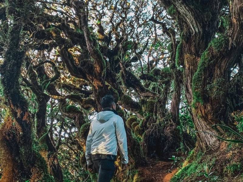
Mount Dulang-Dulang, with a peak rising above the clouds at 2938 meters above sea level, is the second-highest mountain in the Philippines. This mountain, often called by hikers as Mount “D2,” is also one of the country’s most famous mountains.
You can find Mount Dulang-Dulang in the province of Bukidnon within Mindanao island, southern Philippines. Along the hiking trails to the summit of Mount Dulang-Dulang, you will see different landscapes varying from pine forests to mossy forests and grasslands.
However, if there’s a part of Mount Dulang-Dulang that’s totally unmissable, it’s its mossy forest. If there is one feature of Mount Dulang-Dulang that made it famous, it’s definitely its mossy forest.
The mossy forest of Mount Dulang Dulang looks absolutely enchanting! The trees here have twisted branches, comparable to fairytale movies and elven forests. Some hikers even describe the mossy forest of Mount Dulang-Dulang as the Rivendell (a fictional place in the movie “Lord of the Rings”) of the Philippines.
You can also witness a sea of clouds from the summit of Mount Dulang-Dulang. But do you know what can make your visit or hike to Mount Dulang-Dulang unique? It’s the immersion to Talaandig or Higaonon tribe.
You will discover a fascinating culture before you hike Mount Dulang-Dulang. These tribes have an ancestral claim to the mount Dulang Dulang. And indeed, before climbing the mountain, one must first seek a blessing from the leader of the tribe.
Rituals, chicken sacrifice, and the hanging of white bands at the summit are just some of the respect-manifesting activities that add to the mystical character of Mount Dulang Dulang.
Mountaineers like Mark Osorio, who has been to Mount Dulang Dulang, have enjoyed the company of these tribes.
He said, “It made me realize that we can’t just judge a place and its people based on rumors and stereotypes until we have proven it wrong by staying there for a while.”
How to go to Mount Dulang Dulang?
Land travel to Mount Dulang Dulang starts from Cagayan De Oro City if you are coming outside of Mindanao. In Cagayan De Oro City, find Agora Terminal, and from there, take a bus to Malaybalay, Bukidnon. In Malaybalay, ride the jeepneys headed to Lantapan.
Mount Dulang-Dulang hiking difficulty:
Mount Dulang Dulang is a major climb with a difficulty score of 6 on a scale of 9. You would need 2 days to finish the hike and 10 hours to reach the summit. On the trail, you will walk along rugged terrain, do scrambling and climb easy cliffs (beginners should be protected by a rope)
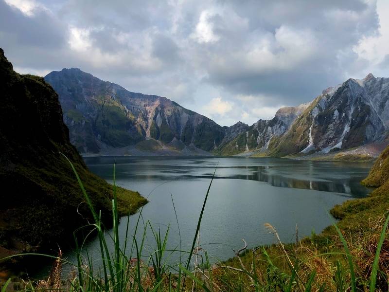
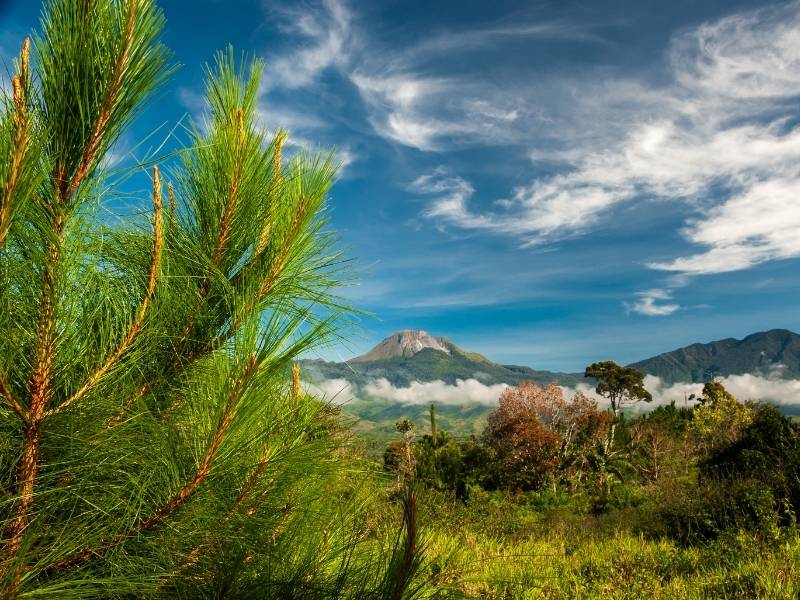
8. Mount Pinatubo
For me, one of the reasons why the mountains in the Philippines are so fascinating to hike is because their beauty is diverse like Filipinos. If you will notice, it is already evident in the 10 famous mountains in this post.
Of all the mountains in this post, Mount Pinatubo is definitely the one that you’ll find so stunning. This volcano, sitting in the provinces of Tarlac and Zambales, has a postcard-level view from its crater. Mount Pinatubo has a crater lake. And, with its rocky peaks, enthralling scenery is seen, similar to the Canadian Rockies.
Indeed, Mount Pinatubo is an incredible masterpiece of nature.
Did you know? This mountain once stood more than 1700 meters above sea level. When it erupted in 1991, it significantly destroyed itself, lowering its height to 1486m. Because Mount Pinatubo’s beauty was created from destruction, people dubbed Mount Pinatubo, the “Beautiful Disaster.”
There are several ways to go to the crater lake of Mount Pinatubo. The easiest is by riding a 4×4 jeep plus a two-hour hike to the crater. During the 4×4 jeep ride, visitors experience an out-of-this-world adventure on the surface or fields of frozen lahar. On your way to the crater on a 4×4, you’ll pass by sharp triangular hills that can already fill you with awe.
The entire 4×4 ride lasts for nearly an hour. You must expect a sweaty hike after the 4×4 ride. The hiking trail has very few parts with tree cover.
It is best to go to Mount Pinatubo from December to February. Aside from milder temperatures and clear skies, it is when the color of the lake turns magnificent cyan.
How to go to Mount Pinatubo?
From Metro Manila, take a bus to Capas, Tarlac, then head to Sta. Juliana. Lastly, register and get your 4×4 jeep on Sitio Daipili. It is where you can start your adventure on Mount Pinatubo.
Tip: it is better to join Facebook groups or travel agencies when going to Mount Pinatubo. They will eliminate the hassle of transportation and save you money from renting a 4×4 jeep.
Mount Pinatubo hiking difficulty:
The hike to Mount Pinatubo is a minor climb. It has a difficulty score of 2 out of 9. The trail leading to the crater is very easy; it would only require walking with care.
7. Mount Ulap
One of the most accessible mountains on this list is Mount Ulap. This mountain, located in Tuba Municipality in Benguet Province, is the favorite hiking destination of the travelers of Baguio City. It only takes 40 minutes to reach Mount Ulap’s jump-off site from Baguio city.
At 1846 meters above sea level, travelers and hikers on top of Mount Ulap enjoy a scenic view of the Cordillera mountain range. If the weather favors you, you can see the stunning scenery of mountains in different shades of blue. Among those mountains are Mount Pulag and Mount Ugo.
One of the attractions in Mount Ulap is Pong-Ol Burial Caves. This cultural attraction can be your unique experience for this mountain. However, the last time I checked, it was closed to the public because authorities were conducting a study. (see the resources section for more information)
Because of its easy access to the public, weekend hikes seem less fun and less relaxing due to the crowd swarming Mount Ulap. People often form queues in Gungol Rock, a highlight of the trail, to take photos during weekends. When the line is already lengthy, a visitor gets only a 15 seconds chance to do their pose.
How to go to Mount Ulap?
From Metro Manila, ride any bus headed to Baguio City. In Baguio, hop on a jeepney to Barangay Ampucao, where you register, secure guides, and start your hike to Mount Ulap.
Mount Ulap hiking difficulty:
Mount Ulap is a minor hike with a difficulty score of 3 out of 9. The whole hike would take only a day unless you want to do overnight camping. The trek to reach the summit typically lasts only two to three hours. It would only involve walking along a rugged/steep terrain and a few scrambling.
6. Mount Balagbag
Among all the mountains on the list, Mount Balagbag is the one closest to Metro Manila. It is situated in Rodriguez in Rizal Province, only two hours away from the metro.
Fun fact, Mount Balagbag belongs to the Sierra Madre, the longest mountain range in the Philippines. Believe it or not, this mountain range spans over 540 kilometers (340 miles) along half of the length of Luzon Island.
Mount Balagbag stands only 777 meters above sea level, making it the famous mountain in the Philippines with the lowest elevation. Although that is the case, you can still see magnificent views from its peak.
This famous mountain of the Philippines is visited by many to do overnight camping and enjoy the overlooking view of the city, filled with glittering city lights.
During the day, you should also see a scenic view of the Sierra Madre’s mountain range transition to Central Luzon’s flat plains. You can spot the Ipo watershed from Mount Balagbag, as well.
The trails in Mount Balagbag are spacious. That’s why so many mountain bikers love climbing this mountain. Some parts of Mount Balagbag are barren and grasslands; this makes hiking during midday impossible due to intense heat. Late afternoon or early morning treks are recommended.
How to go to Mount Balagbag?
From Cubao in Quezon City, Metro Manila, ride a bus heading to Tungko (drop off in BDO Tungko). After reaching Tungko, hop on a jeep heading to Licao-Licao. There you can walk or rent a tricycle to transport you to the Barangay registration site to sign up for hiking.
If you have a 4×4 jeep or a pick-up, you can drive directly near the Balagbag campsite.
Mount Balagbag hiking difficulty:
Mount Balagbag is a minor hike with a difficulty of 3 out of 9. Trekking in Mount Balagbag would only be just a stroll over rugged terrain. The hike could last for 2 days as you might want to have an overnight camp. The trek, however, from base to the summit only lasts for an hour or two.
5. Mount Guiting Guiting
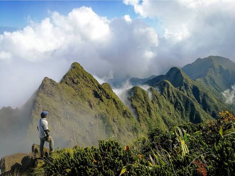
They say the virtues of a true mountaineer, patience and perseverance, are put to the test when climbing Mount Guiting Guiting. Conquering this famous mountain is one of the most challenging hikes in the Philippines.
In fact, Filipino hikers climb this mountain as their preparation before hiking Mount Everest.
Mount Guiting Guiting stands 2048 meters on a small island of Sibuyan in the province of Romblon, 187 nautical miles from Manila. There at the top, lies the view of its marvelous craggy peaks—the part of Mount Guiting-Guiting that made it so famous in the hiking society online and offline.
The stories I read about Mount Guiting-Guiting amazed me deeply.
I salute the determination and strength of every hiker that has reached Mount Guiting-Guiting’s summit. Trekking on top of Mount Guiting-Guiting’s knife edge ridge and the “kiss the wall” section of the trail seem impossible to pass, but these hikers made it through.
How to go to Mount Guiting-Guiting?
From Metro Manila, get a bus ride to Batangas Pier, then take the ferry to Ambulong Port in Magdiwang, Romblon. Proceed to the local Tourism Council to register and begin your adventure. Get the exact details here.
Mount Guiting-Guiting hiking difficulty:
Hiking on Mount Guiting Guiting is a major climb, and it rates 9 out of 9 in terms of difficulty. The assault to the summit takes 10 to 13 hours to finish, and the number of days you would spend on the trail would be around 3. Mount Guiting Guiting has a trail class of 5, meaning hikers would be using free hands as a climbing method.
4. Mount Apo
Mount Apo, being the tallest mountain in the Philippines, is undoubtedly famous as it is taught in schools as the country’s highest peak. Almost everyone in the country knows what Mount Apo is.
However, Mount Apo is not only famous because the schools mention it to kids. For local hikers, going to Mount Apo’s summit is a meaningful hike. Stepping foot on top of Mount Apo is an achievement for every local hiker.
For me, to be at the summit of Mount Apo figuratively means that I have conquered the entire country. At 2956 meters, nowhere else in the Philippines can you stand higher to have an overlooking view of the country.
By the way, where can you find Mount Apo?
You can find Mount Apo in the provinces of Davao del Sur and North Cotabato in Mindanao. From the jump-off location to the summit, you should be able to see the different features of Mount Apo. Expect to discover its swaps, cogon grasslands, and pine forest.
Then, at the summit, it’s mostly rocky, filled with wild berries and temperate plants.
Bodies of water, like waterfalls and lakes, exist in the landscape of Mount Apo. You must see Lake Akgo on trails and crystal clear Lake Venado, a camping site in mount Apo.
Conquering Mount Apo is not easy, but it’s going to be adventurous and fun. Hiking in Mount Apo involves climbing a 90-degree trail and river crossings through coconut logs without any hold for support. After the tiring yet rewarding hike, you can relax in Mainit Hot Spring or take a refreshing bath in Bongolanon waterfalls.
How to go to Mount Apo?
Starting from Metro Manila, book a plane going to Davao City. After arriving at Davao City, take the van going to Kidapawan. In Kidapawan, proceed to the tourism office and register for a hike in Mount Apo, secure guides. After your registration, move ahead to Barangay Ilomavis to start hiking.
Tip: Arrange a trip before flying to Mount Apo for faster and easier transportation.
Mount Apo hiking difficulty:
Mount Apo is a major hike and is rated 7 out of 9 in terms of difficulty. There are a few trails for hiking Mount Apo. One of them, the Kidapawan-Magpet trail, involves only walking on rugged terrain and scrambling. It takes 10 to 11 hours to hit the summit and would require 3 days to finish the whole adventure.
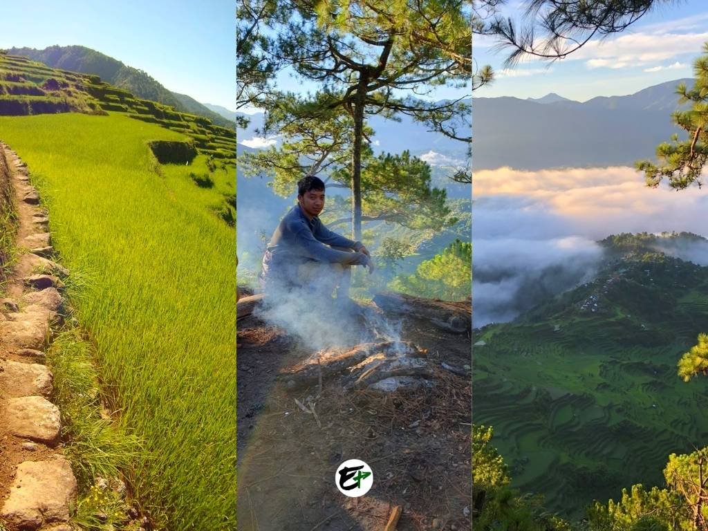
3. Mount Kupapey
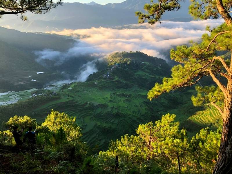
If you ask me, “what’s the most worth visiting hiking destination in the Philippines?” I won’t think twice; my answer will be Mount Kupapey. On Mount Kupapey’s summit, 1650 meters (5413 feet) above sea level, lies the scenery you won’t forget.
During pleasant weather, the panorama of the mountains, a sea of clouds, and a breathtaking view of the Maligcong Rice Terraces await you. When I went to Mount Kupapey, I could not believe what I saw. It’s an absolutely marvelous beauty. If you go here, make sure you’ll catch the sunrise—it’s spectacular.
Before sunrise, you’ll see the valley below Mount Kupapey covered by a sea of clouds. As the sun rises, the clouds disappear, uncurtaining the rice terraces beneath them. The mountains surrounding Maligcong rice terraces cut the radiance of the sun towards the terraces.
This makes each step of the rice terraces glow one by one as the sun begins to peek higher and higher above the mountain.
So, where is Mount Kupapey?
Mount Kupapey is one of the peaks of Maligcong, a small barangay in the municipality of Bontoc. For me, Mount Kupapey parallels Mount Pulag for the awe it can give its visitors.
Awe-filling scenery does not end at the summit of Mount Kupapey. The descent from the peak is a unique experience, especially for Filipinos wanting a real encounter with their heritage. The hiking trail from the summit traverses Maligcong rice terraces, which are a testimony to Filipino’s ingenuity and unparalleled hard work.
You must read my article about my hike and guide to Mount Kupapey and Maligcong Rice Terraces. There you will know why this mountain is absolutely worth hiking.
How to go to Mount Kupapey?
From Cubao, Quezon City, Metro Manila, ride on a bus heading to Bontoc, Mountain Province. Alight the bus in downtown Bontoc where you will find a jeepney terminal bound for Maligcong.
If you cannot find the terminal, rent a tricycle and ask the driver to bring you to the said place. Ride the jeep to Maligcong; the travel time to your destination from the terminal would last 30 minutes.
Mount Kupapey hiking difficulty:
Mount Kupapey is a minor hike with a difficulty of 3 on a scale of 9. It would only take 3 hours for anyone to get to the summit. Unless you plan to camp overnight, the hike would only last for a day. The trail involves stiff and rugged terrain. Expect scrambling a few times.
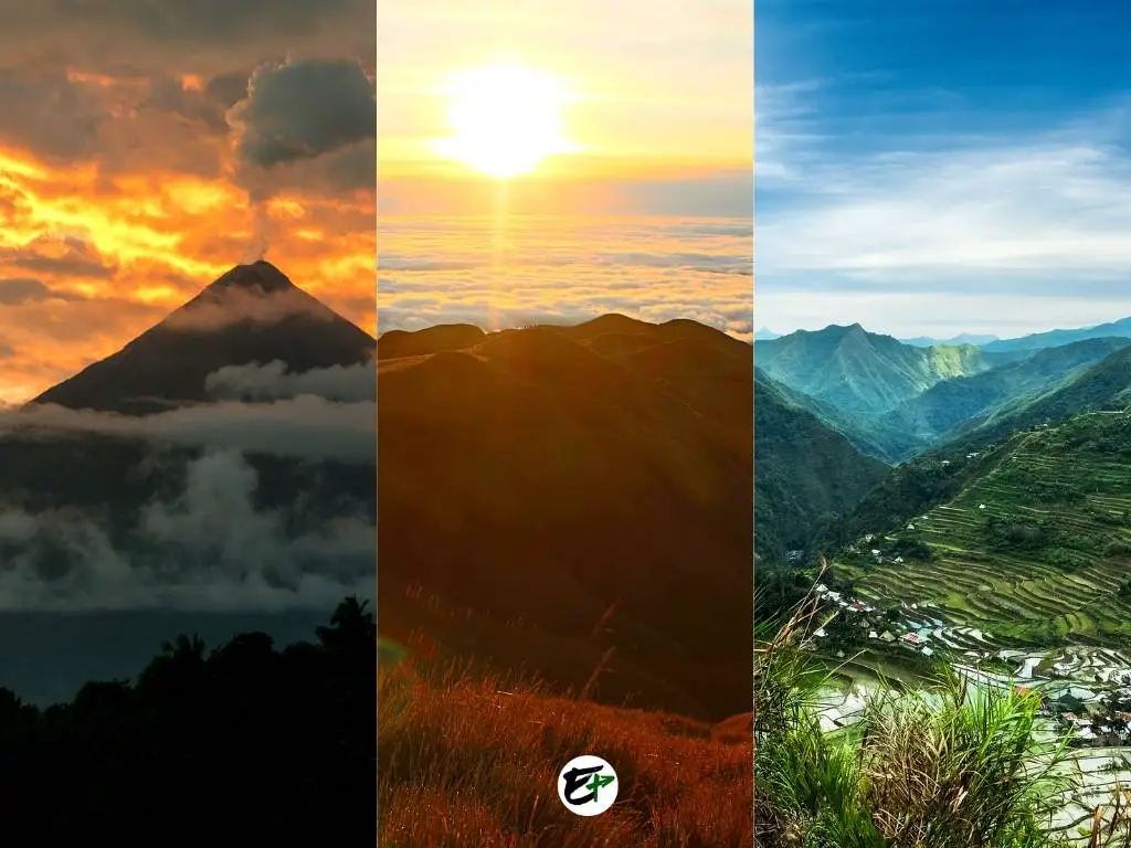
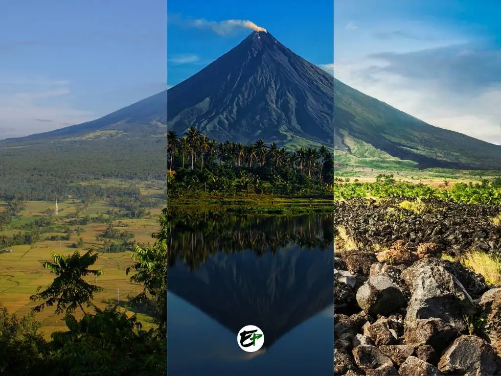
2. Mount Mayon
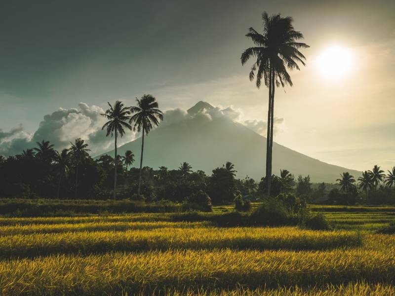
Of all the famous mountains in the Philippines, Mount Mayon is the one which is undoubtedly known all around the world. Being one of the very few mountains to have a perfect cone shape, there’s no doubt why Mount Mayon gets international attention.
Honestly, you do not have to hike to see awe-inspiring mountain beauty. You can just go to Albay, stay in a house in Legazpi with a view of Mayon, and enjoy the extraordinary panorama.
Who would not be mesmerized by its beauty? Is there anyone who does not wonder how it was formed? With a height of 2463 meters and a different shape, spotting it from a distance is effortless.
Do you want to hike Mayon? Sadly, authorities don’t allow hiking on Mount Mayon due to its recent volcanic activities. So visitors and hikers only admire it from afar. Stay tuned with Phivolcs to know when it will be accessible to hikers again.
However, before it was closed to the public, some had been to the summit crater and successfully conquered it. These hikers said the trail they’ve been to is composed of forest, grasslands, and lava flow rock formations. They climbed rocks and traversed a knife-edge-like part of the trail.
By the way, there are many things to see and things to do around Mount Mayon! They are not only sightseeing but also adventure and time with family. Learn more about the tourist attractions around Mount Mayon.
How to go to Mount Mayon?
From Metro Manila, hop on a bus straight to Legazpi City, Albay. The bus ride would give you 11 hours of endless sight of the Philippine countryside. Alternatively, you can book a plane that flies 30 to 45 minutes straight to Albay if you’re short of time.
Mount Mayon hiking difficulty:
Mount Mayon is a major climb that takes 3 days to finish. The trail difficulty is rated 7 out of 9 and shall involve walking on a rugged path, scrambling, and climbing freehand with ropes and guides.
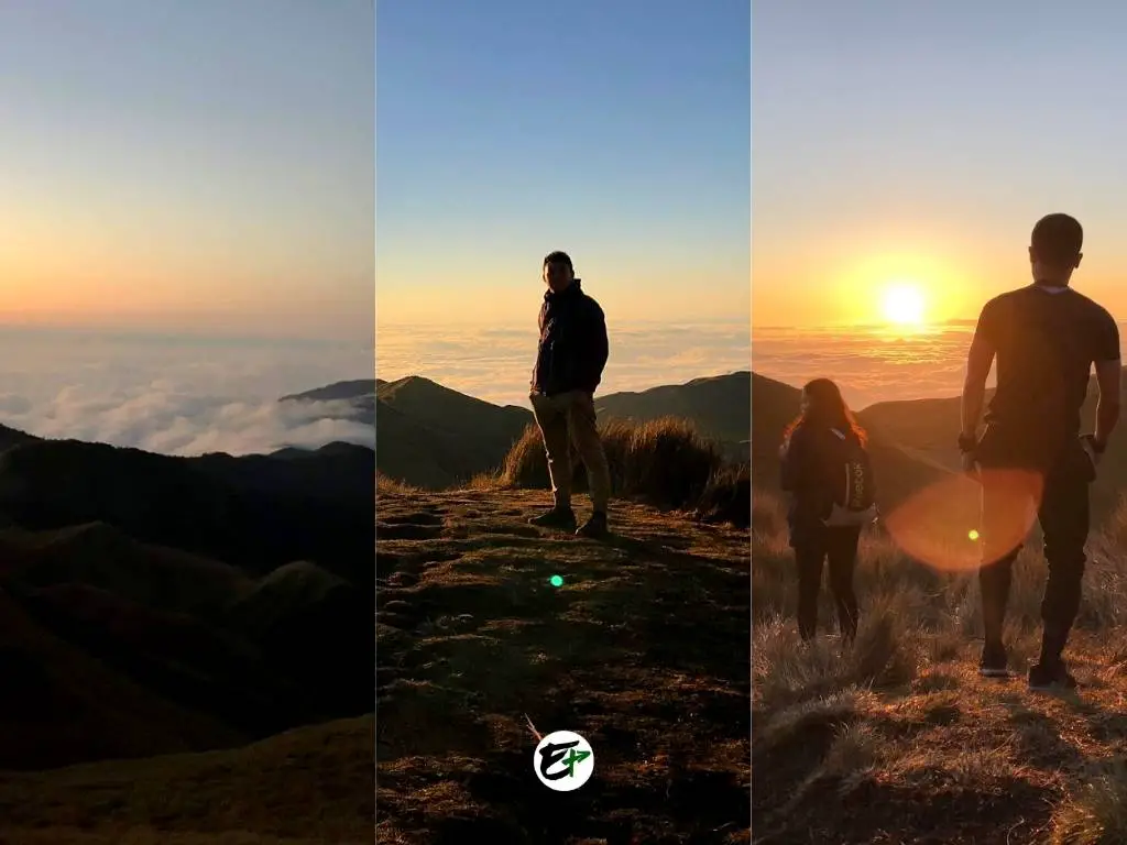
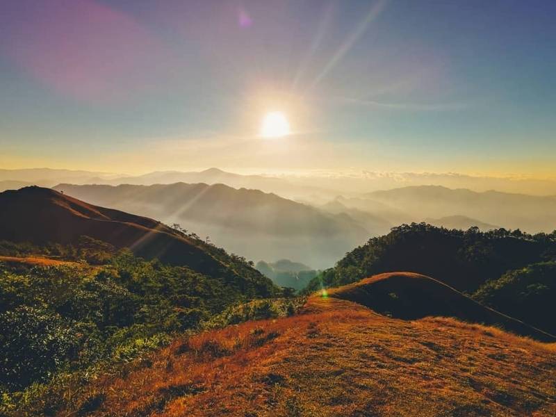
1. Mount Pulag
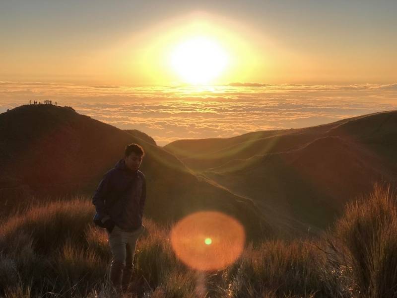
For me, Mount Pulag is a special place. Well, actually, it’s really a notable place! Why? Mount Pulag is the coldest place in the Philippines, a country with everlasting summer. If you’re a Filipino wanting to experience “winter,” Mount Pulag won’t let your expectations down!
Another reason is that Mount Pulag, with a height that’s 2926 meters above sea level, is the Philippines’ third tallest mountain. Its peak is the point where the borders of the three provinces meet (Benguet, Nueva Vizcaya, and Ifugao). Isn’t it cool that you are in Benguet, Nueva Vizcaya, and Ifugao all at the same time when you are standing at their peak?
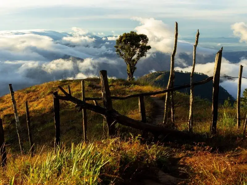
Beyond these, the most compelling reason to hike Mount Pulag is the unparalleled panorama you can see from its summit, especially during sunrise with a sea of clouds! The grasslands on its peak turn into golden islands above the clouds.
Like Mount Dulang-Dulang and Mount Apo, Mount Pulag also has a mossy forest that looks so enchanting. It’s the part of the hike that will not let you pass without taking photos.
To me, Mount Pulag is the best mountain to hike because it has hiking trails that fit all people with different hiking experiences. Most importantly, everyone can have an absolutely rewarding view once they reach the summit.
How to go to Mount Pulag?
From Metro Manila, take a bus heading to Baguio City. Rent a taxi to transport you to Kabayan Terminal. Take a van or bus to Kabayan and tell the driver or the bus conductor to drop you off at the DENR office.
After reaching the DENR office and taking your orientation, rent a Habal-Habal driver to help you arrive at the ranger station to start your hike.
See my guide in hiking Mount Pulag to learn more.
Mount Pulag hiking difficulty:
Hiking Mount Pulag is a major climb that takes 1 to 2 days to finish. The trail difficulty (Ambangeg—the easiest hiking trail) is rated 3 out of 9 and involves walking on rugged terrain and scrambling. Traversing the trail from jump-off to summit lasts for 4 to 5 hours.
Philippine Mountains With Sea of Clouds
If you’re dreaming of witnessing a sea of clouds, your best chance is to venture to peaks that rise over 2000 meters above sea level. Mountains such as Mt. Pulag, Mt. Apo, Mt. D2, Mt. Amuyao, and Mt. Ugo are renowned for this mesmerizing phenomenon. You might also find luck at Mt. Kupapey and Mt. Balagbag, or any mountain that overlooks a valley with stable air mass conditions.
However, it’s crucial to remember that altitude alone doesn’t guarantee a view of a sea of clouds. The weather plays a pivotal role. The more stable the atmosphere, the higher your chances of beholding this breathtaking sight.
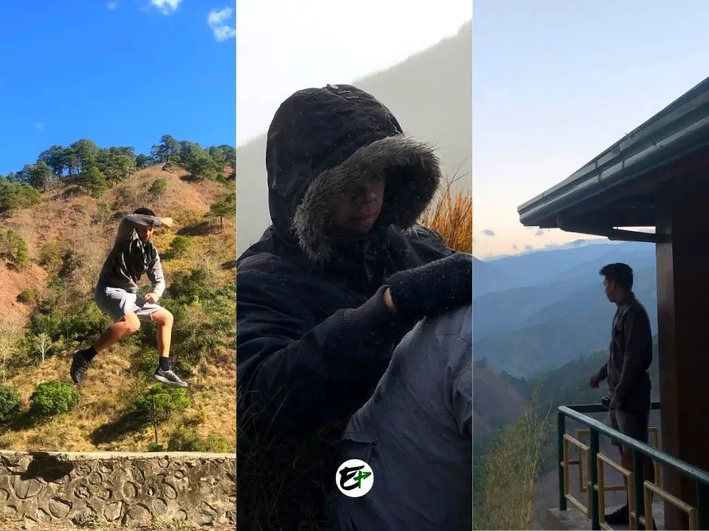
At an altitude of 2000 meters (or 6560 feet), you can expect milder or single-digit temperatures (in Celsius). So, if you’re planning to scale high-altitude mountains in pursuit of a sea of clouds, don’t forget to pack a jacket!
I had my own encounter with this in January 2019 when I ascended Mt. Pulag, hoping to see a sea of clouds. During my first hike on Mount Pulag, I faced freezing temperatures that nearly dropped to 0° Celsius. So, always be prepared!
Conclusion: Famous Mountains In The Philippines
So, that’s it! Those are the 10 famous mountains in the Philippines. What do you think?
For me, mountains in the Philippines have their own unique beauty. Hiking some of them even entails discovering the culture and ingenuity of the locals. With these and the stunning scenery you can see from their peaks, there’s no wonder why they have become the Philippines’ famous mountains.
Discover more top attractions in the Philippines!
Resources: Philippine Mountains
Save it on Pinterest.