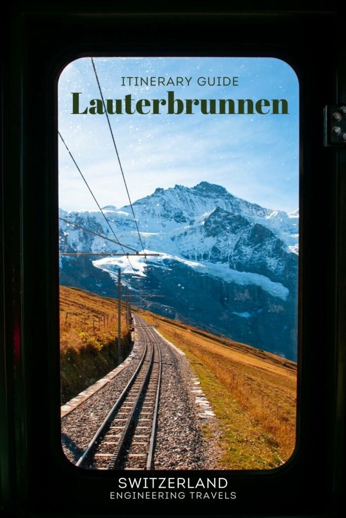
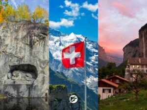
How to Get to Lauterbrunnen: Nearest Cities, Towns, Villages
Lauterbrunnen, situated in Switzerland, is easy to reach thanks to the country’s efficient and reliable train network. There’s no need for a car or bus. From any town in Switzerland, a train ride to Interlaken is all it takes. Once in Interlaken, a scenic 20-minute train journey will bring you to Lauterbrunnen.
If you’re planning to fly, Zurich is an excellent choice as a starting point to reach Lauterbrunnen. As Switzerland’s largest city, it offers numerous flight connections worldwide, often at more affordable prices. The journey from Zurich to Lauterbrunnen takes about 2 hours and 30 minutes.
However, your starting point for the journey to Lauterbrunnen may not necessarily be Zurich. It could vary depending on your origin, other places in Switzerland you wish to visit first, and means of transportation you prefer.
In this post, we’ll discuss Lauterbrunnen’s nearby the towns, where you can start to get to Lauterbrunnen. We’ll also cover how to navigate the Lauterbrunnen valley once you arrive. With the information provided in this post, planning your Lauterbrunnen itinerary, both before and during the trip, becomes a breeze.
This post contains affiliate links. I may receive a tiny commission at no additional cost to you.
Use the table of contents to skip to topics.
Important Notes
Take note, this blog post contains several tables. These tables present information about the distance and travel time when using public transportation or a private vehicle to and from Lauterbrunnen. For those interested in the methodology behind the data, please refer to the Resources Section.
For the “Public Transportation” tables, you will see:
- The city or town you’ll be departing from or planning to visit next.
- Max Transfers and Min Transfers — Commute Difficulty — The columns in the table indicate the number of transfers, either by bus or train, needed to reach your destination. There are two columns for this category because the operation of different buses or trains in Switzerland, such as IC and RE, is not synchronized throughout the day. For instance, a direct train might be available from Place A to Place B during daytime hours. However, at night, this direct service may not be available, necessitating a transfer. In such a scenario, the Max Transfer would be 1, indicating “2 train rides,” while the Min Transfer would be 0, signifying a “Direct” route. Remember, fewer transfers typically result in a more convenient commute.
- Max Travel Time and Min Travel Time— Travel Duration — Similar to commute difficulty, there are two columns due to the varying schedules of trains and buses. The ‘travel time’ column provides an estimate of the shortest and longest possible transit times. Please note, these estimates include any waiting time between transfers.
For the “Private Vehicle” Tables, you will see:
- The city or town you’ll be departing from or planning to visit next.
- The distance, provided in both kilometers and miles, can help you estimate your fuel or charging costs based on the fastest route.
- Travel time is an estimate based on ideal driving conditions, again considering the fastest route.
Before planning your trip to Lauterbrunnen, it’s helpful to understand its location.
In quick summary:
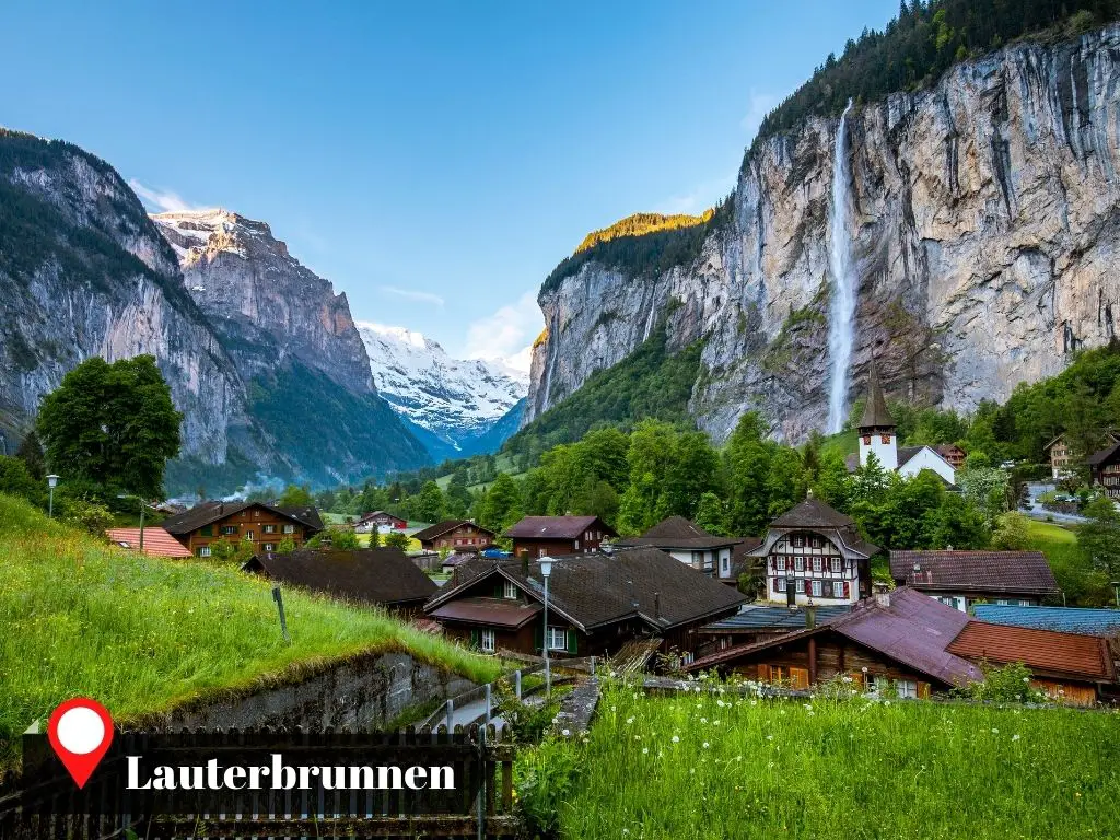
- Lauterbrunnen is a commune nestled in the heart of the Bernese Alps, about 65 kilometers (or 40 miles) southeast of Bern.
- The commune includes a village, also named Lauterbrunnen, situated at the base of a valley of the same name.
- This village is surrounded by stunning waterfalls and towering mountains that exceed 3000 meters (or 9800 feet) in height. These include the renowned Eiger, Monch, and Jungfrau, the three most celebrated mountains in Lauterbrunnen.
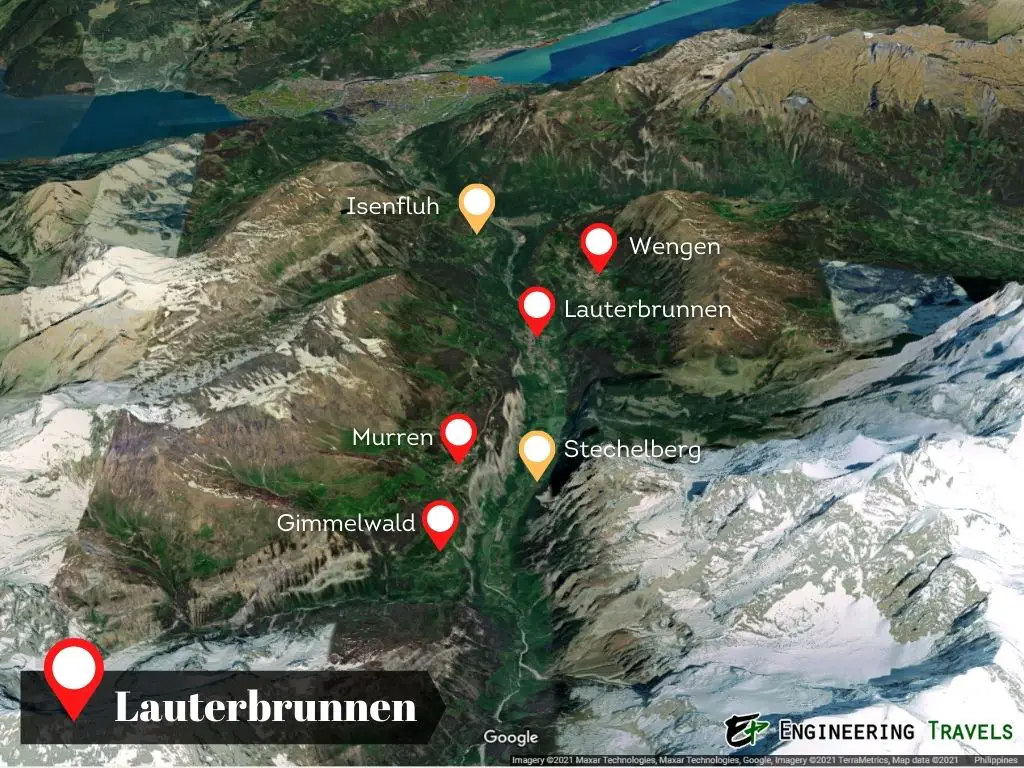
- Within the valley, the village of Lauterbrunnen is encircled by neighboring villages. These include Stechelberg, Wengen, Murren, Isenfluh, and Gimmelwald, all of which form the entire commune.
If you’re considering a trip to the Jungfrau Region with a visit to Lauterbrunnen, the following articles could be of great assistance to you.
- A Lauterbrunnen Guide in Discovering Its Best Experiences
- 1- to 3-Day Lauterbrunnen Itinerary
- 7-Day Jungfrau Region Itinerary (from Interlaken, including Lauterbrunnen)
- 14-Day Switzerland Itinerary (including Lauterbrunnen)
If you are visiting Lauterbrunnen and you’re still in search of accommodation, consider using this hotel browser. It offers some of the best hotel deals in both Lauterbrunnen and the broader Jungfrau Region.

How to Get to Lauterbrunnen from Switzerland’s Major Cities
If you’re traveling from abroad to visit Lauterbrunnen in Switzerland, you have a choice of four international airports for your arrival. These airports are situated in the main cities of Switzerland: Zurich (ZRH), Geneva (GVA), Basel (BSL), and Bern (BRN).
From these major Swiss cities, you can catch a train to Interlaken. Interlaken is the final stop before reaching Lauterbrunnen. The travel time from Interlaken to Lauterbrunnen is a mere 20 minutes.
Also, if you’re arriving from other European countries, you’ll likely need to change trains at these cities to reach Lauterbrunnen.
How far is Lauterbrunnen from Switzerland’s major cities using public transportation?
| City | Commute Difficulty (Max Transfer) |
Commute Difficulty (Min Transfers) |
Travel Time (Maximum) |
Travel Time (Minimum) |
|---|---|---|---|---|
| Zurich | 3 train rides | 4 train rides | 3h 49m | 2h 23m |
| Geneva | 3 train rides | 4 train rides | 3h 37m | 3h 13m |
| Basel | 2 train rides | 4 train rides + 2 bus rides |
4h 31m | 2h 27m |
| Bern | 2 train rides | 2 train rides + 1 bus ride |
2h 18m | 1h 29m |
How far is Lauterbrunnen from Switzerland’s major cities using a private vehicle?
| City | Distance from Lauterbrunnen in Kilometers (Miles) | Travel Time |
|---|---|---|
| Zurich | 128 km (80 mi) | 1h 49m |
| Geneva | 225 km (140 mi) | 2h 29m |
| Basel | 157 km (97 mi) | 1h 51m |
| Bern | 72 km (45mi) | 57m |
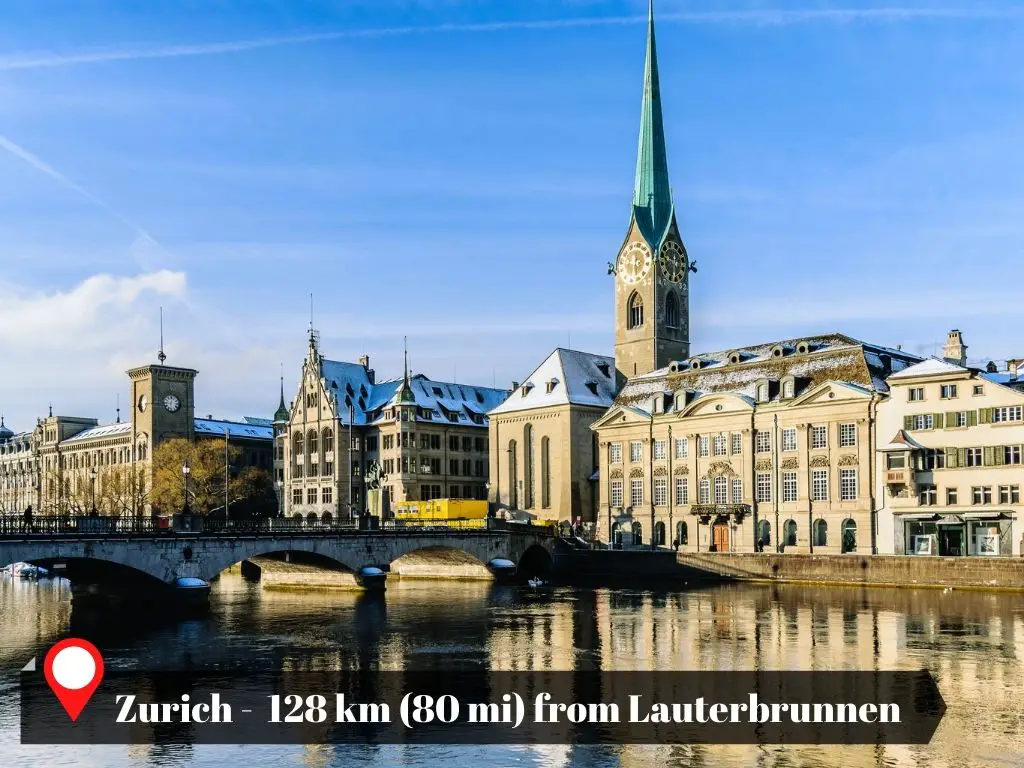
Zurich
Lauterbrunnen is located 128 kilometers (or 80 miles) southwest of Zurich.
Zurich, the largest city in Switzerland, is situated in the northeastern part of the country. If you’re traveling to Lauterbrunnen from Austria or the southern region of Bavaria in Germany, you’ll likely transfer trains in Zurich. While in Zurich, you can indulge in some high-end shopping or savor some exquisite chocolates. Don’t miss the opportunity to admire the picturesque, historic buildings that line the Limmat River.
If you want to explore Zurich before going to Lauterbrunnen, here’s the guide to help you find the best experiences that make Zurich worth visiting. Zurich is more than just a transportation hub.
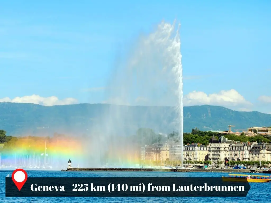
Geneva
Lauterbrunnen is situated to the northeast of Geneva, with a road distance of approximately 225 km (or 140 miles) separating them.
Geneva, located in the westernmost part of Switzerland, is known for being the headquarters of many international organizations. If you’re traveling to Lauterbrunnen from central France, Geneva is likely to be your train transfer point.
Why consider making a stop in Geneva before heading to Lauterbrunnen? The city offers several attractions, including the United Nations’ office, a cathedral with an archaeological site in its basement, and a variety of exhibitions and museums.
While some people may label Geneva as a boring city, I find it to be full of fascinating discoveries. Here is my guide to help you discover why Geneva is a nice destination.
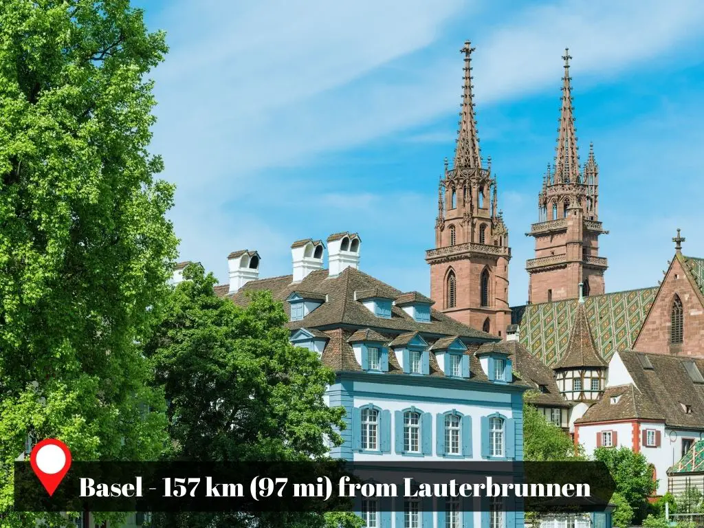
Basel
Lauterbrunnen lies almost directly south of Basel, with a road distance of approximately 157 kilometers (or 97 miles) between them.
Basel, a city in Switzerland, shares its northern border with both France and Germany. It’s recognized as one of Europe’s major cultural hubs, thanks to the numerous museums it hosts.
Three railway networks traverse Basel: Swiss, French, and German. If you’re traveling from northern France or western Germany, you’ll likely switch trains in Basel en route to Switzerland.
If you’re a museum enthusiast, you might want to explore Basel before heading to Lauterbrunnen. One notable destination is the Kunstmuseum, the largest art museum in Switzerland.
Basel deserve a quick stop. Have a look at the beautiful places I discovered in Basel.
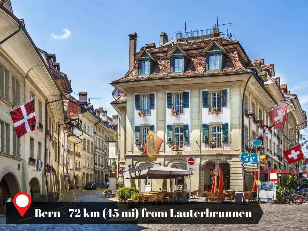
Bern
Bern, Switzerland’s capital, is the closest city to Lauterbrunnen. It hosts an interchange station where trains from Geneva and Zurich transfer to Interlaken and Lauterbrunnen.
While Basel offers direct train services to Interlaken, these trains also make a stop in Bern. Given its proximity, just 72 kilometers (or 45 miles) away, planning day trips from Bern to Lauterbrunnen is more feasible than from Geneva, Basel, or Zurich.
One compelling reason to visit Bern is its picturesque Old City. This area has been a UNESCO World Heritage site since 1983.
I think Bern is the most beautiful city in Switzerland. Bern’s landmarks, streets, attractions, and museums shall explain exactly why.
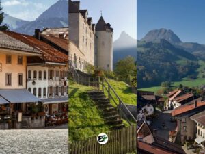
Cities in the Swiss Alps Near Lauterbrunnen
Switzerland is home to several stunning cities located in or near the Swiss Alps. These cities offer a unique appeal compared to the more populated areas in Switzerland’s Central Plateau and the Jura.
The reason is simple: they provide similar historical insights while granting easier access to the breathtaking beauty of the Alps.
Near Lauterbrunnen, you’ll find the Alpine cities of Montreux, Sion, Brig, Thun, and Lucerne. Each of these cities is within a 2 hour and 15-minute drive or less than 3 hours by train or bus from Lauterbrunnen, and vice versa.
For more information about these cities, you can refer to my article titled “The Cities Near the Swiss Alps.” This guide will help you explore the highlights of each city and understand their proximity to other picturesque destinations in the Swiss Alps, much like Lauterbrunnen.
Public transportation: How far is Lauterbrunnen from the cities in the Swiss Alps?
| City | Commute Difficulty (Max Transfer) |
Commute Difficulty (Min Transfers) |
Travel Time (Maximum) |
Travel Time (Minimum) |
|---|---|---|---|---|
| Montreux | 4 train rides + 1 bus ride |
4 train rides | 4h 5m | 2h 42m |
| Sion | 4 train rides | 4 train rides | 3h 26m | 1h 57m |
| Brig | 3 train rides + 1 bus ride |
3 train rides | 3h 19m | 1h 37m |
| Thun | 2 train rides + 1 bus ride |
2 train rides | 1h 31m | 1h |
| Lucerne | 3 train rides + 1 bus ride |
2 train rides | 4h 20m | 2h 19m |
Private Vehicle: How far is Lauterbrunnen from the cities in the Swiss Alps?
| City | Distance from Lauterbrunnen in Kilometers (Miles) | Travel Time |
|---|---|---|
| Montreux | 157 kilometers (97 miles) | 1h 51m |
| Sion | 115 kilometers (71 miles) | 2h 13m |
| Brig | 102 kilometers (63 miles) | 2h 5m |
| Thun | 40 kilometers (25 miles) | 39m |
| Lucerne | 78 kilometers (48 miles) | 1h 24m |
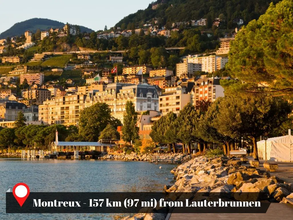
Montreux
Montreux, situated in the westernmost part of the Swiss Alps, lies west of Lauterbrunnen. The road distance between them is 157 kilometers. This city, nestled between Rochers de Naye and Lake Geneva, is known for its annual Jazz festival.
If you’re planning a trip to Switzerland, consider adding Montreux to your itinerary either before or after your visit to Lauterbrunnen. There are several amazing reasons why you must visit Montreux. The best reason: picturesque lake and views of the French Alps.
For fans of Freddie Mercury, a visit to Montreux is an absolute must. Nearby attractions include Chillon Castle, a captivating lakeside castle, and the beautiful UNESCO Lavaux Vinorama vineyards.
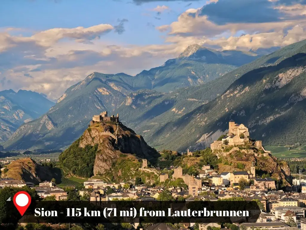
Sion
Sion, the capital of the canton of Valais, is a city nestled in the Rhone Valley. Lauterbrunnen is situated northeast of Sion, with a road distance of approximately 115 kilometers or 71 miles separating them.
The city of Sion is a picturesque town, whose beauty is enhanced by the centuries-old castles that crown its two hills. Inside one of the castle chapels, you’ll find the world’s oldest playable organ.
There are a few more attractions and activities in Sion you can do or see during your visit. Another you might like to try is wine tasting. Sion is home to numerous quality restaurants, offering a selection of excellent local wines.
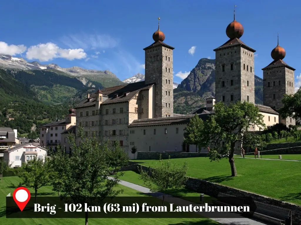
Brig
Brig, located in the heart of the Swiss Alps, is a city that many choose as their base due to its proximity to attractions such as Zermatt and other beautiful Alpine villages. It also serves as a central transport hub in the Alps.
Lauterbrunnen is situated just north of Brig. However, the presence of mountains that rise to 3,000 meters separates the two, extending the road distance between them to 102 kilometers or 63 miles.
Brig is home to several interesting attractions and hidden gems in Switzerland, including the scenic and historical Simplon Pass. The World Nature Forum, a museum that provides a captivating introduction to the Swiss Alps and the Aletsch Glacier, is also located here.
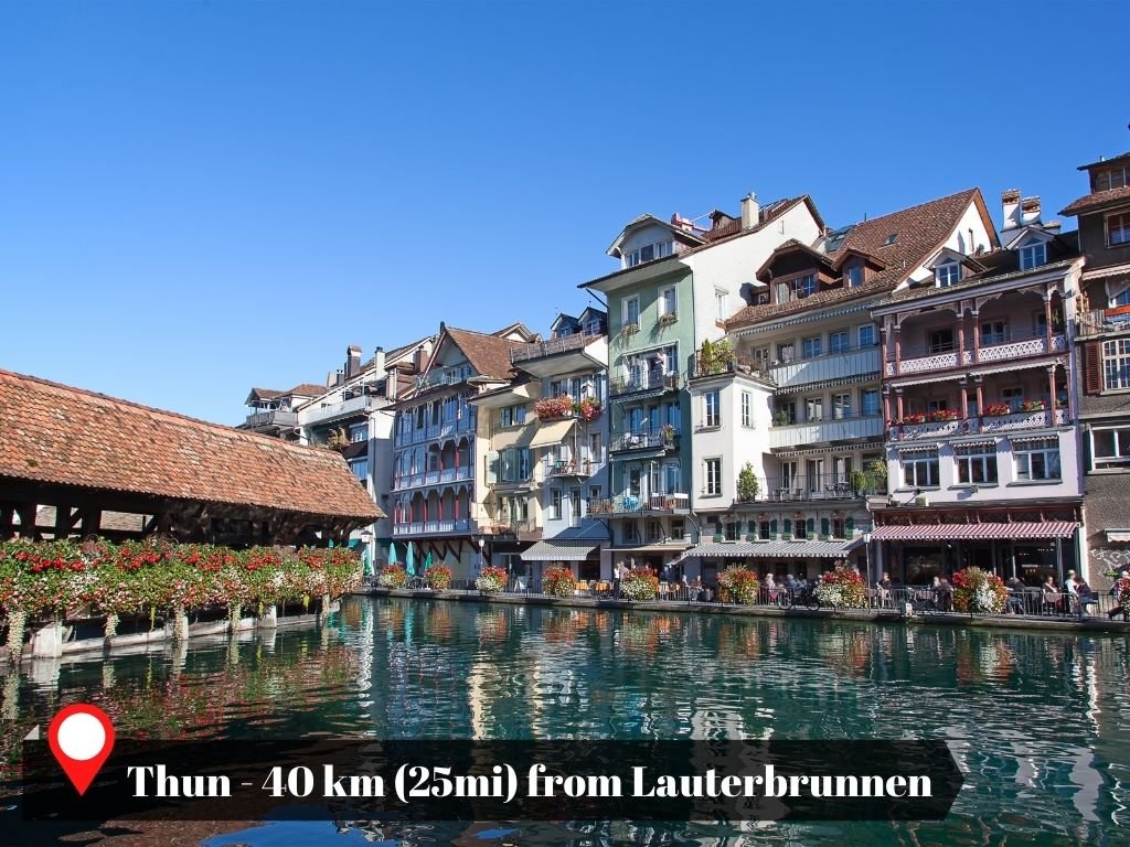
Thun
Thun, nestled in the Swiss Alps, holds the distinction of being the nearest city to Lauterbrunnen and Interlaken. Situated to the northwest of Lauterbrunnen, it’s a mere 40 kilometers (25 miles) away by road.
Much like its counterparts near the Swiss Alps, Thun is home to attractions that could be classified as Switzerland’s lesser-known wonders.
In Thun, you’ll discover the world’s most ancient panorama painting. This remarkable piece of art depicts the town of Thun itself, its serene lake, and the majestic Bernese Alps.
Adding to the city’s charm is a castle, complete with towers that visitors can ascend. From this vantage point, one can appreciate the panoramic view of the town, the lake, and the distant snow-capped mountains.
Thun also offers boat rides that take you on a tour of the lake’s castles, providing yet another unique perspective of this captivating city.
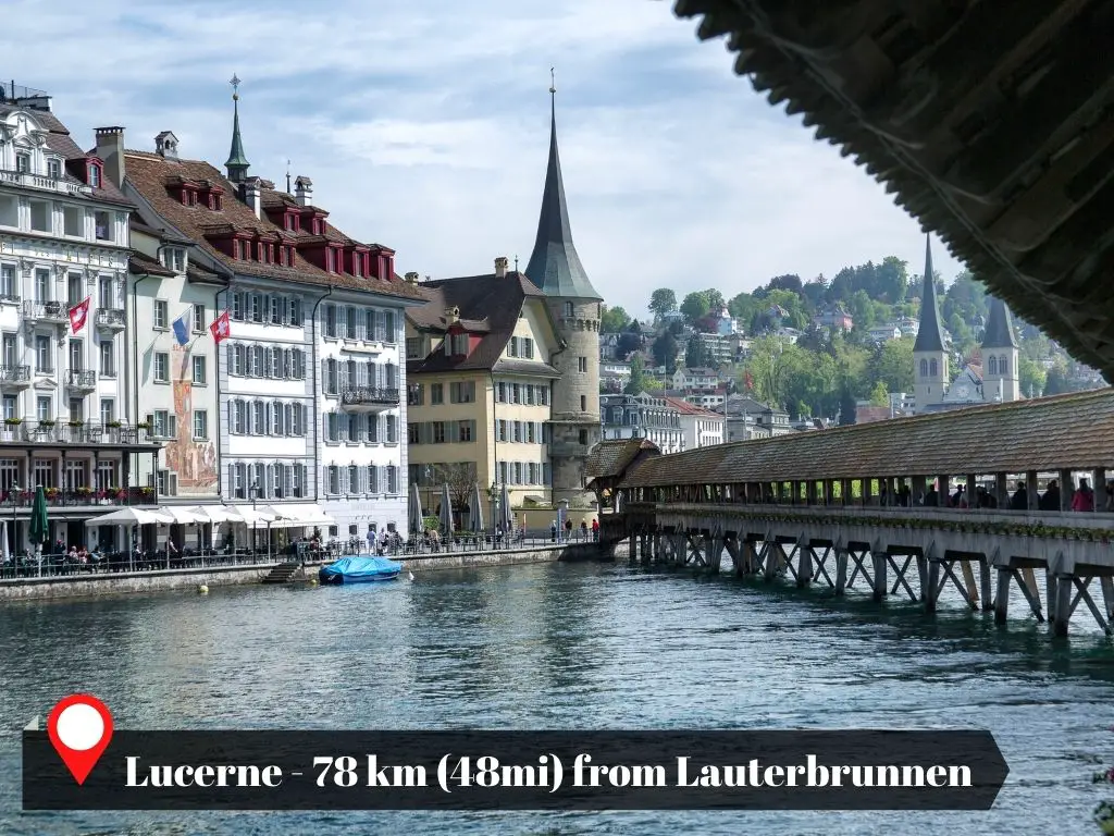
Lucerne
Lucerne is another must-see attraction in Switzerland that warrants a visit either before or after your trip to Lauterbrunnen. Its appeal lies not just in its proximity to Lauterbrunnen, being only 78 kilometers (48 miles) away by car, but also in the multitude of activities and discoveries it offers.
Among the few cities in Switzerland with preserved historic walls, Lucerne stands out. These walls present an impressive sight that adds to the city’s charm. The medieval ambiance, evident in the chapel bridge and the architecture of the old town buildings, offers a journey back in time.
But there’s more to Lucerne. Mount Pilatus, a captivating mountain, is easily accessible from the city. You can ascend this mountain using the world’s steepest rack railway, which has a maximum gradient of 48 percent. This adventure adds another layer to the rich experiences Lucerne provides.
Visiting The Villages in Lauterbrunnen
The village of Lauterbrunnen is not the only place to explore within the municipality of the same name. There are six hamlets or villages in total, four of which offer some of the most stunning scenery and experiences in the Swiss Alps. These are:
- Lauterbrunnen
- Wengen
- Murren
- Gimmelwald
Of these four, only Lauterbrunnen is accessible by car. Your vehicle will remain parked there for the duration of your visit to Lauterbrunnen, unless you choose to drive it to Isenfluh, a hamlet connected to Lauterbrunnen by road.
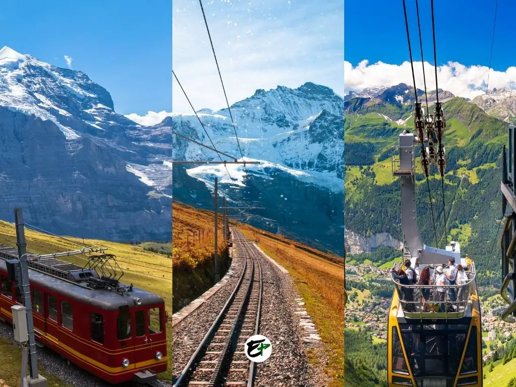
To travel between the other villages, you can either hike or use public transportation, which includes funicular trains, cable cars, and buses.
In the following section, I will share the time and effort required to travel from one village to another. A brief introduction to each village will also be provided.
Important: The trains that service Lauterbrunnen and Wengen, along with bus #141, operate on a schedule with departures every 30 minutes. Also, there’s a train that provides a connection between Grütschalp and Murren. This service is even more frequent, with departures scheduled every 15 minutes.
Lauterbrunnen Village
Lauterbrunnen is the village that you’ll reach when you take the train from Interlaken. It’s recognized for its breathtaking landscape, which is enhanced by the elegant Staubbach falls to the south.
In terms of activities, Lauterbrunnen village itself offers a more laid-back experience. You might want to visit the tourism center, take a leisurely stroll, and discover the most scenic spot in the area.
Once you’ve soaked in the charm of the village, you’re ready to explore the other parts of Lauterbrunnen.
Murren, Gimmelwald, and Wengen serve as gateways to an array of stunning vistas and thrilling destinations in the Jungfrau Region. These villages are your stepping stones to a world of natural beauty and adventure.
In the following section, I’ll provide a summary detailing the time and effort required to travel from Lauterbrunnen to Murren, Gimmelwald, and Wengen. This will give you a clear idea of what to expect on your journey.
| Route | Steps | Travel Time |
|---|---|---|
| Lauterbrunnen to Wengen | 1. Take the inclined train ride from Lauterbrunnen station to Wengen | 11m |
| Lauterbrunnen to Gimmelwald | 1. From Lauterbrunnen, ride on bus 141 to Stechelberg. 2. From Stechelberg, hop on the cable car going to Gimmelwald. |
25m |
|
Lauterbrunnen to Murren (via Gimmelwald) |
1. From Lauterbrunnen, ride on bus 141 to Stechelberg. 2. From Stechelberg, hop on the cable car straight to Murren, passing Gimmelwald. |
31m |
|
Lauterbrunnen to Murren (via Grütschalp) |
1. From Lauterbrunnen, hop on the cable car going to Grütschalp. 2. From Grütschalp, ride on the train going to Murren. |
20m |
You can click the routes to see the path in Google Maps.
Wengen Village
Wengen is a village that overlooks the town of Lauterbrunnen from the north. It serves as the starting point for visits to the eastern mountains of Lauterbrunnen, such as Eiger, Monch, and Jungfrau. Many travelers prefer to stay in Wengen rather than Lauterbrunnen due to its superior views and a wider selection of hotels and shops.
In Wengen, cable cars and trains are readily available to transport you to various destinations. One of these is Männlichen, which offers 360-degree views of Lauterbrunnen. From here, you can see as far as the end of the Lauterbrunnen valley, Grindelwald to the east, and Thun to the north.
Another destination is Kleine Scheidegg. This train station, which is on the route to Jungfraujoch, provides one of the most impressive views of the north face of Eiger.
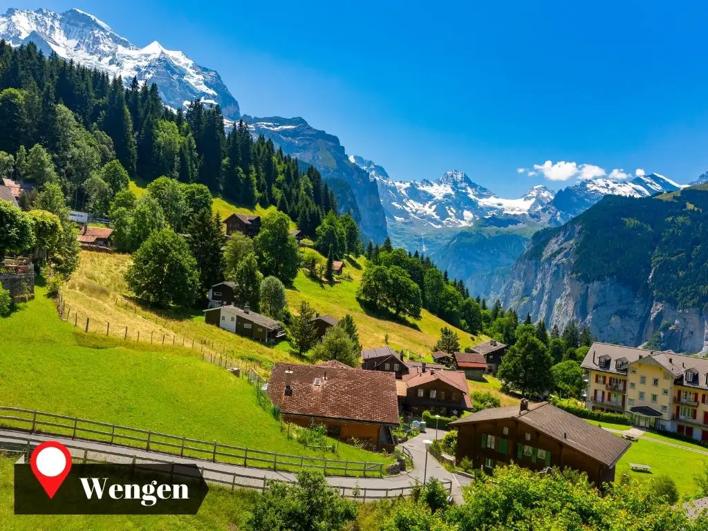
Lauterbrunnen offers additional epic adventures and breathtaking views on the western side of the valley. If you plan to visit these villages or scenic spots from Wengen, the following steps will guide your journey:
| Route | Steps | Travel Time |
|---|---|---|
| Wengen to Lauterbrunnen | 1. Take the inclined train ride from Wengen station to Lauterbrunnen | 13m |
| Wengen to Gimmelwald | 1. Take the inclined train ride from Wengen station to Lauterbrunnen. 2. From Lauterbrunnen, ride on bus 141 to Stechelberg. 3. From Stechelberg, hop on the cable car going to Gimmelwald. |
46m |
|
Wengen to Murren (via Gimmelwald) |
1. Take the inclined train ride from Wengen station to Lauterbrunnen. 2. From Lauterbrunnen, ride on bus 141 to Stechelberg. 3. From Stechelberg, hop on the cable car straight to Murren, passing Gimmelwald. |
1h 2m |
|
Wengen to Murren (via Grütschalp) |
1. Take the inclined train ride from Wengen station to Lauterbrunnen. 2. From Lauterbrunnen, hop on the cable car going to Grütschalp. 3. From Grütschalp, ride on the train going to Murren. |
38m |
You can click the routes to see the path in Google Maps.
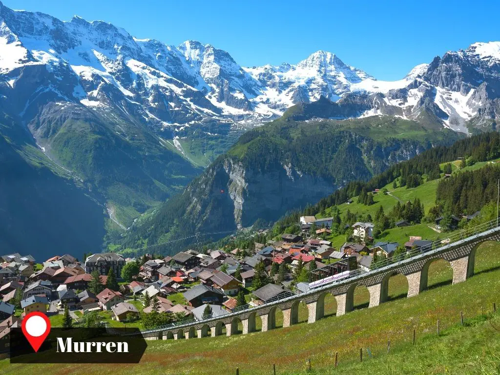
Murren Village
Murren is a village in Lauterbrunnen, perched on a clifftop balcony with a view of Eiger, Monch, and Jungfrau. At an elevation of 1638 meters (5374 feet), it is the highest village in Lauterbrunnen.
The village serves as a gateway to the stunning views of Eiger, Monch, and Jungfrau. Two notable locations are:
- Birg – This peak in the western mountains of Lauterbrunnen offers dining options and a viewing platform. The platform features decks with glass floors and bridges constructed from steel mesh.
- Schilthorn – Another peak in the western mountains of Lauterbrunnen, Schilthorn is home to a revolving restaurant at its summit.
If you are planning to visit other villages from Murren for a more comprehensive mountain experience, consider the following routes and travel times:
| Route | Steps | Travel Time |
|---|---|---|
|
Murren to Gimmelwald (cable car) |
1. Hop on the cable car at the station going to Gimmelwald | 4m |
|
Murren to Gimmelwald (hiking – downslope) |
1. Walk south of Murren to Murrenbach River 2. Follow the Lussi trail going south and hike for 2.4 km |
32m |
|
Murren to Lauterbrunnen (via Gimmelwald) |
1. Go to the south of Murren where the cable car station is 2. Hop on a cable car heading to Stechelberg, passing Gimmelwald 3. In Stechelberg, ride bus #141 from Stechelberg to Lauterbrunnen |
30m |
|
Murren to Lauterbrunnen (via Grütschalp) |
1. Go to the north of Murren where the train station is 2. Ride on a train heading to Grütschalp 3. From Grütschalp, hop on the cable car going down to Lauterbrunnen |
19m |
|
Murren to Wengen (via Gimmelwald) |
1. Go to the south of Murren where the cable car station is 2. Hop on a cable car heading to Stechelberg, passing Gimmelwald 3. In Stechelberg, ride bus #141 from Stechelberg to Lauterbrunnen 4. In Lauterbrunnen, get the train ride going to Wengen |
46m |
| Murren to Wengen (via Grütschalp) |
1. Go to the north of Murren where the train station is 2. Ride on a train heading to Grütschalp 3. From Grütschalp, hop on the cable car going down to Lauterbrunnen 4. In Lauterbrunnen, get the train ride going to Wengen |
43m |
You can click the routes to see the path in Google Maps.
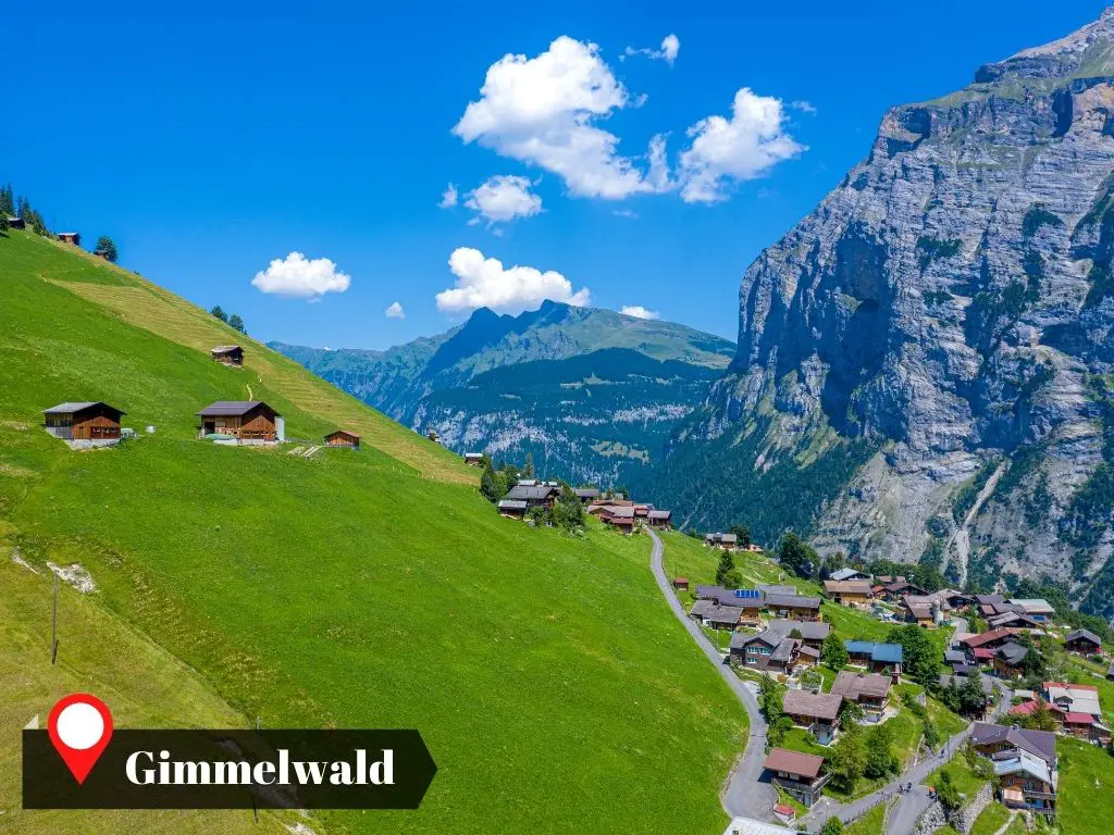
Gimmelwald Village
Gimmelwald is nestled in the southernmost part of Lauterbrunnen. This is where many begin their hikes to enjoy the views of Tanzbödeli.
Despite being the smallest, Gimmelwald holds its own as the most idyllic village when compared to Wengen, Lauterbrunnen, and Murren.
If you’re seeking a tranquil experience and wish to savor the beauty of Lauterbrunnen away from the crowds, Gimmelwald is the village to visit.
If you are currently in Gimmelwald and considering a visit to other attractions in Lauterbrunnen, the following steps and travel times should be taken into account:
| Route | Steps | Travel Time |
|---|---|---|
|
Gimmelwald to Murren (Cable car) |
1. Hop of a cable car going to Murren | 5m |
|
Gimmelwald o Murren (Hike – upslope) |
1. Proceed to the northern portion of Gimmelwald 2. Hike along the Lussi Trail, 2.4 kilometers in length |
44m |
| Gimmelwald to Lauterbrunnen | 1. Hop on a cable car going down to Stechelberg 2. In Stechelberg, ride bus #141 heading to Lauterbrunnen |
25m |
| Gimmelwald to Wengen | 1. Hop on a cable car going down to Stechelberg 2. In Stechelberg, ride bus #141 heading to Lauterbrunnen 3. At Lauterbrunnen’s train station, ride the train up to Wengen |
41m |
You can click the routes to see the path in Google Maps.
Resources
The data presented in the tables I shared with you can be cross-checked using Google Maps’ Schedule Explorer. This feature becomes accessible when you search for directions.
I utilized this tool to ensure that you can easily validate the information I’ve provided. For each route in the tables, I’ve included corresponding links to Google Maps. These links are intended to serve as your point of reference.
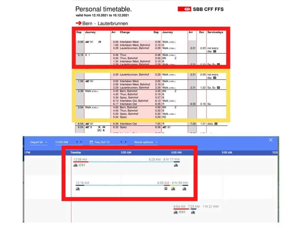
You can access the Schedule Explorer as shown in the screenshot provided below.
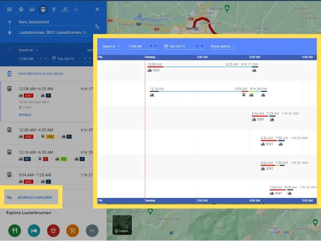
In order to verify the reliability of Google Maps for planning commuting trips in Switzerland, I conducted a comparison. This involved assessing data from Google Map’s Schedule Explorer and juxtaposing it with the timetables provided by SBB.
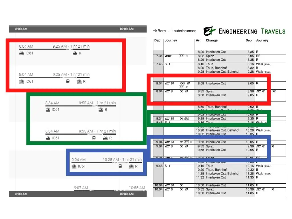
As depicted in the image above, Google Maps provides fairly accurate commuting directions for each hour of the day. While it may not display all routes, it offers sufficient information to make quick and accurate estimates of commuting difficulty and travel time throughout the day.
It’s important to note that Google Maps may not be as efficient in providing commuting directions between 10 p.m. and 6 a.m. However, I don’t perceive this as a significant issue for the data presented above. It’s likely that during these hours, we would be at our hotels, possibly resting. Please refer to the image below for more details.
I consistently cross-reference the information from Google Maps with SBB timetables. You can be confident that these data serve as accurate approximations.
However, it’s important to remember that these data represent estimates under ideal conditions. Factors such as traffic conditions and weather should also be taken into account.
That would be all! I hope this helps.
Save it on Pinterest.